
World
Description
Links
Facts
Reports
Guides and maps
Lodging
Organisations
Tour operators
GPS
Other
Books


The Book Depository
United Kingdom
United Kingdom
- Wild Signs and Star Paths
- 52 keys that will open your eyes, ears and mind to the world around you Read more


The Book Depository
United Kingdom
United Kingdom
- Great Hiking Trails of the World
- 80 Trails, 75,000 Miles, 38 Countries, 6 Continents Read more

The Book Depository
United Kingdom
United Kingdom
- City Walks Edinburgh
- 15 short, fun and informative city walks bringing Edinburgh to life Read more


The Book Depository
United Kingdom
United Kingdom
- The Secret World of Weather
- How to Read Signs in Every Cloud, Breeze, Hill, Street, Plant, Animal, and Dewdrop Read more

The Book Depository
United Kingdom
United Kingdom
- Moon Tokyo Walks (First Edition)
- See the City Like a Local Read more

The Book Depository
United Kingdom
United Kingdom
- Resilient Hope
- 100 Devotions for Building Endurance in an Unpredictable World Read more
Maps

Stanfords
United Kingdom
United Kingdom
- Roeselare NGI Topo 19-20 - WWI Ypres Salient Battlefields
- Roeselare, map No. 19-20 in the topographic survey of Belgium at 1:50,000 covering the northern sector of the Ypres Salient battleground of World War I, north of the Paschendaele/Passendale – Boezinge line, including Steenstraat. Map legend includes English.Although not specifically designed to highlight locations connected with WWI, the map... Read more

Stanfords
United Kingdom
United Kingdom
- Czechia Shocart-F&B Road Map
- Indexed road map of Czech Republic at 1:250,000, with 1:100,000 scale enlargements of Prague, Ústí nad Labem, Karlovy Vary, Ceské Budejovice, and Plzen. The main map shows the major road network and some minor roads, with road distances marked in kilometres; filling stations are shown. Railway lines and airports are clearly displayed.Topography... Read more

Stanfords
United Kingdom
United Kingdom
- World War I Macedonian Front: Lake Dorjan
- Lake Dorjan, one of two maps covering the site of the Battle of Doiran between British and Greek troops against Bulgarian forces on the Macedonian Front during World War I. Both maps are reproductions by G.H. Smith & Son of the original British Army trench maps at approximately 7/10th of the original scale quoted against each title.This title,... Read more
Stanfords
United Kingdom
United Kingdom
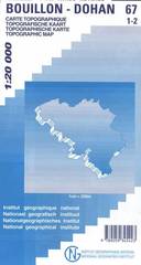
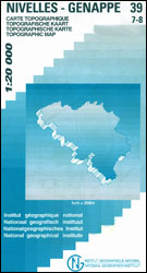
- Bouillon - Dohan
- Topographical survey of Belgium at 1:20,000 from Nationaal Geografisch Instituut / Institut Géographique National, the country’s national survey organization. Each 20K map covers one quarter of the corresponding 1:50,000 map (with adjustments in the border and coastal areas). The maps provide all the information expected of topographic mapping... Read more

Stanfords
United Kingdom
United Kingdom
- Geraardsbergen - Galmaarden
- Topographical survey of Belgium at 1:20,000 from Nationaal Geografisch Instituut / Institut Géographique National, the country’s national survey organization. Each 20K map covers one quarter of the corresponding 1:50,000 map (with adjustments in the border and coastal areas). The maps provide all the information expected of topographic mapping... Read more

Stanfords
United Kingdom
United Kingdom
- Cuba Wall Map
- Wall map of Cuba from Gizi with excellent topographic information, a street plan of Old Havana, enlargements for the Varadero Peninsula, Valle de Viñales and the environs of the capital, plus a distance table and an extensive index.Vivid altitude colouring with graphics for mangrove and swamps, plus plenty of names of geographical features:... Read more

Stanfords
United Kingdom
United Kingdom
- Jurbise - Obourg
- Topographical survey of Belgium at 1:20,000 from Nationaal Geografisch Instituut / Institut Géographique National, the country’s national survey organization. Each 20K map covers one quarter of the corresponding 1:50,000 map (with adjustments in the border and coastal areas). The maps provide all the information expected of topographic mapping... Read more
Stanfords
United Kingdom
United Kingdom
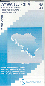
- Aywaille - Spa NGI Belgium Survey Map No. 49/3-4
- Topographical survey of Belgium at 1:20,000 from Nationaal Geografisch Instituut / Institut Géographique National, the country’s national survey organization. Each 20K map covers one quarter of the corresponding 1:50,000 map (with adjustments in the border and coastal areas). The maps provide all the information expected of topographic mapping... Read more

Stanfords
United Kingdom
United Kingdom
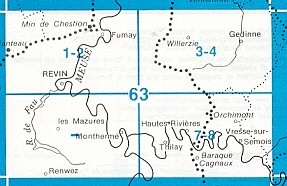
- Gedinne
- Topographical survey of Belgium at 1:20,000 from Nationaal Geografisch Instituut / Institut Géographique National, the country’s national survey organization. Each 20K map covers one quarter of the corresponding 1:50,000 map (with adjustments in the border and coastal areas). The maps provide all the information expected of topographic mapping... Read more
Stanfords
United Kingdom
United Kingdom
- Ans - Liège 20K NGI Belgium Survey Map No. 42/1-2
- Topographical survey of Belgium at 1:20,000 from Nationaal Geografisch Instituut / Institut Géographique National, the country’s national survey organization. Each 20K map covers one quarter of the corresponding 1:50,000 map (with adjustments in the border and coastal areas). The maps provide all the information expected of topographic mapping... Read more

Stanfords
United Kingdom
United Kingdom
- Barcelona - Zaragoza - Castellón de la Plana 500K CNIG Regional Map No. 7
- The Mediterranean coast of Spain between Barcelona and Castellón de la Plana, extending west to Zaragoza and Teruel, at 1:500,000 in a series of regional road maps from the country’s civilian survey organization IGN-CNIG (Instituto Geográfico Nacional - Centro Nacional de Información Geográfica), vividly presenting the topography by altitude... Read more

Stanfords
United Kingdom
United Kingdom
- Europe Children`s Placemat
- This is a colourful and resistant placemat by Little Wigwam, featuring a political map of Europe with capitals and major cities. All the information is up-to-date and includes Serbia, Kosovo and Montenegro. The seas are named, lines of longitude and latitude are shown at 15 degree intervals, the Arctic Circle is marked and the mat features a... Read more
Stanfords
United Kingdom
United Kingdom
- Vise - St-Martens-Voeren
- Topographical survey of Belgium at 1:20,000 from Nationaal Geografisch Instituut / Institut Géographique National, the country’s national survey organization. Each 20K map covers one quarter of the corresponding 1:50,000 map (with adjustments in the border and coastal areas). The maps provide all the information expected of topographic mapping... Read more
Stanfords
United Kingdom
United Kingdom
- Dalhem - Herve
- Topographical survey of Belgium at 1:20,000 from Nationaal Geografisch Instituut / Institut Géographique National, the country’s national survey organization. Each 20K map covers one quarter of the corresponding 1:50,000 map (with adjustments in the border and coastal areas). The maps provide all the information expected of topographic mapping... Read more