
London
Description
Capital of the United Kingdom. All sorts of walks. The Thames Path runs right through the city center and you can hop on the London Eye after being fooled at the ticket counter and view forward and backward on your trail.
Trails in this region
Links
Facts
Reports
Guides and maps
Lodging
Organisations
Tour operators
GPS
Other
Books
Stanfords
United Kingdom
United Kingdom
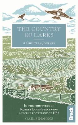
- Country of Larks: A Chiltern Journey: In the footsteps of Robert Louis Stevenson and the footprint of HS2
- Shortlisted for the 2020 Edward Stanford Travel Writing Award`s Lonely Planet Debut Travel Writer of the YearTravel writer and journalist Gail Simmons follows in the footsteps of Robert Louis Stevenson as she walks from High Wycombe in Buckinghamshire to Tring in Hertfordshire via Great Missenden and Wendover, tracing not only the changes in... Read more

Stanfords
United Kingdom
United Kingdom
- London`s Hidden Walks: Volumes 1-3
- People love walking the streets of London, but there are always more questions than answers after a stroll through the capital. These books are packed with interesting details about London`s history with fascinating stories and more general historical facts. This box set combines volumes 1, 2 and 3 in an attractive slip case. Each volume... Read more

Stanfords
United Kingdom
United Kingdom
- London Marco Polo Spiral Guide
- London in the Marco Polo Spiral Guides series is a practical guide presenting the most important things to see and do in the city in a nutshell, and aimed at travellers who don’t have a lot of time to prepare and research for a trip. The guide highlights the top 10 sights, suggests tours and great ideas for exciting days out, and features... Read more

Stanfords
United Kingdom
United Kingdom
- DK Eyewitness Great Britain
- Three unique nations interwoven into a rich cultural tapestry, this small island has huge character.Whether you want to tour elegant stately homes, marvel at prehistoric wonders or take a windswept walk along cliff-top paths, your DK Eyewitness travel guide makes sure you experience all that Great Britain has to offer.From the jagged peaks of... Read more

Stanfords
United Kingdom
United Kingdom
- A Historical Riverside London Pub Walk
- Discover London’s ancient Riverside pubs, set in an area that was for centuries home to pirates, smugglers, shipbuilders, pilgrims and the infamous Execution Dock. The pubs and the sites are in the Wapping and, across the Thames, the Rotherhithe area of east London, and where appropriate the guide provides information on opening hours and phone... Read more

Stanfords
United Kingdom
United Kingdom
- Walking Haunted London
- Updated for the most intrepid London visitors and residents, “Walking Haunted London” is a spine-chilling guide that wends it way through eerie and, in many cases, long-forgotten parts of one of the world`s greatest cities.From ”Deadman`s Walk” and the ”Screaming Wood” to ”Dick Turpin” and ”Jack the Ripper”, professional tour guide and... Read more

Stanfords
United Kingdom
United Kingdom
- Londoners: The Days and Nights of London Now
- Londoners by Craig Taylor is a collection of approximately 80 short stories told by people who live in the capital. The result is a kaleidoscopic view of London through the experiences of people from all walks of life: from the taxi driver and the artist to the protester, the cruiser, the squatter, the police officer and the civil engineer.... Read more


Stanfords
United Kingdom
United Kingdom
- An Historical Walk Through William Shakespeare`s London
- Handy pocket size guide to locations in London associated with Shakespeare and his times. Starting at the Blackfriars tube station and crossing over the Thames to the Bankside area and the Globe theatre, the guide takes in diverse range of sites including the George Inn, Clink Prison, the Golden Hinde ship of Sir Francis Drake, etc. Where... Read more

Stanfords
United Kingdom
United Kingdom
- Great House
- Shortlisted for the Orange Prize for Fiction 2011, Nicole Krauss` ”Great House” is a haunting story that explores loss and memory. In New York a woman spends the night with a young Chilean poet before he departs, leaving her at his desk. Later, he is arrested by Pinochet`s secret police...In north London, a man caring for his dying wife... Read more

Stanfords
United Kingdom
United Kingdom
- South Downs - 20 Country Walks For All The Family
- Batsford`s Walking Guides is an exciting new gift series of walking books, aimed at the weekend, family walker. These small-format, portable, hardback books have an attractive retro feel, with nostalgic line drawings and hand-drawn maps. Each of the 20 walks have been carefully selected to appeal to family walkers, most are circular and none... Read more

Stanfords
United Kingdom
United Kingdom
- Middlesex and West London - Waterside Walks
- Waterside Walks in Middlesex and West London by David and Rosemary Hall presents a selection of twenty circular walks that take in some part of a local waterway. These include the rivers Thames and Colne, the Staines Reservoirs, Dollis Brook and the Grand Union Canal. The twenty routes in this book are all between 3 to 7 miles. Each walk is... Read more

Stanfords
United Kingdom
United Kingdom
- Railway Walks: LMS
- Jeff Vinter, consultant to the BBC`s popular ”Railway Walks” series, here provides a detailed guide to ten of the best railway walks in the territory of the former London Midland and Scottish Railway. These range from the Midland Railway`s express line through the Peak District to the incredible Cromford and High Peak Railway, built before... Read more

Stanfords
United Kingdom
United Kingdom
- Walks in the London Borough of Enfield - Volume 1
- Walks in the London Borough of Enfield Volume 1 by John Merrill is a guidebook to walking in London’s most northerly borough. With some 40 miles of footpaths - including parts of the London Loop, River Lee Navigation path, Pymmes Brook Trail and the New River Path - the Borough of Enfield has much to offer the walker. This guide lists twelve... Read more

Stanfords
United Kingdom
2021
United Kingdom
2021
- DK Eyewitness England`s South Coast
- Windswept cliffs, breathtaking beaches, and vibrant cities: welcome to the stunning south of England.Whether you want to relax on the sandy shores of Cornwall, wander around London`s famous museums or browse vintage shops in Brighton, your DK Eyewitness travel guide makes sure you experience all that this region has to offer.England`s South... Read more
Maps

Stanfords
United Kingdom
United Kingdom
- Ontario Southwestern: Brantford - London - Kitchener/Waterloo - Bruce Peninsula
- The south-western part of Ontario on a detailed, double-sided road map at 1:250,000 extending from Lake Erie to Lake Huron and the Bruce Peninsula, with five street plans at 1:25,000 covering central London, Windsor, Sarnia, Owen Sound and Stratford.Coverage of the region is divided between the two sides of the map, with a good overlap between... Read more

Stanfords
United Kingdom
United Kingdom
- Runners London in a Box: Beautiful running routes around London on individual handy, pocket-size cards
- 32 incredible running routes intelligently located all over Greater London. In this unique, boxed collection of folding, pocket-size cards you`ll find a variety of running routes around Greater London. Each card has a different route fully described and illustrated on a large scale, 1:25 000 map and include our carefully planned pitstops along... Read more

Stanfords
United Kingdom
United Kingdom
- London East 1920-1921
- Map No. 177, London East 1920-1921, in the Cassini Historical Series of old Ordnance Survey mapping of England and Wales at 1:50,000 in a format designed to offer a convenient comparison with the present day coverage from the OS, and most locations in three different editions. Old historical maps have been combined so that the sheet lines... Read more

Stanfords
United Kingdom
United Kingdom
- London
- London at 1:50,00 with mapping from the Ordnance Survey’s Landranger series published by Cassini to add to their extensive coverage of the city on historical maps reflecting different periods in its development. Unlike the Landranger series which splits the city east/west, the Cassini version is centred on Charing Cross and covers most of the... Read more

Stanfords
United Kingdom
United Kingdom
- Luxembourg North
- One of two topographic survey maps of Luxembourg at 1:50,000, with contours at 10-metres intervals and additional relief shading. An overprint highlights long-distance footpaths, including the GR5 (E-2), cycle routes, and various places of interest, including campsites. The map covers an area of approximately 53 x 43 km / 33 x 27 miles. Map... Read more
Stanfords
United Kingdom
United Kingdom
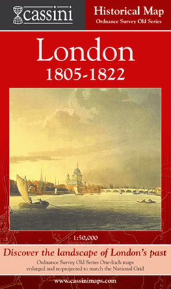
- London 1805-1822
- London in 1805-1822 in the Cassini Historical Series reproducing old Ordnance Survey mapping of England and Wales at 1:50,000. The four London maps cover roughly the area of the present day Greater London rather than following the format of rest of the series which is designed to correspond to the current Landranger maps. Mapping is identical... Read more
Stanfords
United Kingdom
United Kingdom
- London West 1805-1920 (3-map set)
- Map No. 176, London West 1805-1920 (3-map set), in the Cassini Historical Series of old Ordnance Survey mapping of England and Wales at 1:50,000 in a format designed to offer a convenient comparison with the present day coverage from the OS, and most locations in three different editions. Old historical maps have been combined so that the sheet... Read more
Stanfords
United Kingdom
United Kingdom
- London East 1805-1922 (3-map set)
- Map No. 177, London East 1805-1922 (3-map set), in the Cassini Historical Series of old Ordnance Survey mapping of England and Wales at 1:50,000 in a format designed to offer a convenient comparison with the present day coverage from the OS, and most locations in three different editions. Old historical maps have been combined so that the sheet... Read more

Stanfords
United Kingdom
United Kingdom
- Luxembourg South
- One of two topographic survey maps of Luxembourg at 1:50,000, with contours at 10-metres intervals and additional relief shading. An overprint highlights long-distance footpaths, including the GR5 (E-2), cycle routes, and various places of interest, including campsites. The map covers an area of approximately 53 x 43 km / 33 x 27 miles. Map... Read more
Stanfords
United Kingdom
United Kingdom
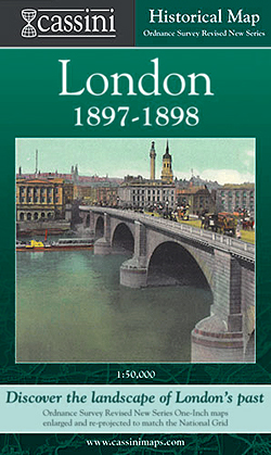
- London 1897-1898
- London in 1897-1898 in the Cassini Historical Series reproducing old Ordnance Survey mapping of England and Wales at 1:50,000. The four London maps cover roughly the area of the present day Greater London rather than following the format of rest of the series which is designed to correspond to the current Landranger maps. Mapping is identical... Read more

Stanfords
United Kingdom
United Kingdom
- Sonoma Valley Biking and Hiking Trails
- Sonoma Valley on a contoured hiking and biking map from Map Adventures showing local conservations areas, detailed classification of recreational trails, wineries, etc. On one side a map at 1:30,000 covers the northern part of the valley along the Sonoma Highway from Glen Ellen to Santa Rosa, including the Taylor Mountain Regional Park, Annadel... Read more

Stanfords
United Kingdom
United Kingdom
- England Coast Path Adventure Map - Minehead to Brean Down
- The A-Z Adventure Series of maps combines the best of OS and A-Z, creating the perfect companion for walkers, off-road cyclists, horse riders and anyone wishing to explore the great outdoors.This official Minehead to Brean Down Adventure Map covers a 58 mile (93km) section of the England Coast Path, a new National Trail around England`s coast.... Read more

Stanfords
United Kingdom
United Kingdom
- Ontario MapArt Pocket Road Atlas
- Pocket road atlas of Ontario presenting the southern part of the province at 1:700,000 with the northern part at 1:1,500,000, plus enlargements showing in greater detail 25 municipal areas and downtown street plans for 21 locations, a map showing Highway Service Centres, etc..The atlas presents the southern part of the province at 1:700,000,... Read more
Stanfords
United Kingdom
United Kingdom
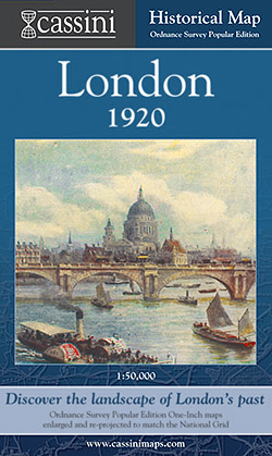
- London 1920
- London in 1920 in the Cassini Historical Series reproducing old Ordnance Survey mapping of England and Wales at 1:50,000. The four London maps cover roughly the area of the present day Greater London rather than following the format of rest of the series which is designed to correspond to the current Landranger maps. Mapping is identical to the... Read more

Stanfords
United Kingdom
United Kingdom
- Cycle Tours Chilterns, Hertfordshire & Essex
- This spiral-bound guide describes 20 wonderful bike rides in the countryside to the north and west of London. The area offers some excellent and varied cycling: from the challenges of the steep wooded escarpment of the Chilterns in the west to the gentle gradients on networks of quiet lanes in Hertfordshire and north Essex. The book contains 15... Read more