
Stanfords
United Kingdom
- Brighton and Hove Past and Present
- Brighton and Hove in the Cassini Past and Present map series which covers town and cities of England and Wales and offers a unique way of tracing their history and expansion by showing four different periods of their development using Ordnance Survey mapping from the mid-19th century, the late 19th century, the 1920s and the present day.... Read more

Stanfords
United Kingdom
- Peterborough 1824-1836
- Map No. 142, Peterborough 1824-1836, in the Cassini Historical Series of old Ordnance Survey mapping of England and Wales at 1:50,000 in a format designed to offer a convenient comparison with the present day coverage from the OS, and most locations in three different editions. Old historical maps have been combined so that the sheet lines... Read more
Stanfords
United Kingdom
- Kingston upon Hull 1903-1908
- Map No. 107, Kingston upon Hull 1903-1908, in the Cassini Historical Series of old Ordnance Survey mapping of England and Wales at 1:50,000 in a format designed to offer a convenient comparison with the present day coverage from the OS, and most locations in three different editions. Old historical maps have been combined so that the sheet... Read more

Stanfords
United Kingdom
- Stratford-upon-Avon, Warwick and Royal Leamington Spa Past and Present
- Stratford-upon-Avon, Warwick and Royal Leamington Spa in the Cassini Past and Present map series which covers town and cities of England and Wales and offers a unique way of tracing their history and expansion by showing four different periods of their development using Ordnance Survey mapping from the mid-19th century, the late 19th century,... Read more
Stanfords
United Kingdom
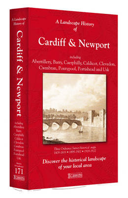
- Cardiff and Newport / Caerdydd & Casnewydd 1813-1922 (3-map set)
- Map No. 171, Cardiff and Newport / Caerdydd & Casnewydd 1813-1922 (3-map set), in the Cassini Historical Series of old Ordnance Survey mapping of England and Wales at 1:50,000 in a format designed to offer a convenient comparison with the present day coverage from the OS, and most locations in three different editions. Old historical maps have... Read more
Stanfords
United Kingdom
- Grantham 1901-1903
- Map No. 130, Grantham 1901-1903, in the Cassini Historical Series of old Ordnance Survey mapping of England and Wales at 1:50,000 in a format designed to offer a convenient comparison with the present day coverage from the OS, and most locations in three different editions. Old historical maps have been combined so that the sheet lines... Read more
Stanfords
United Kingdom
- Manchester Central Past and Present
- Manchester Central in the Cassini Past and Present map series which covers town and cities of England and Wales and offers a unique way of tracing their history and expansion by showing four different periods of their development using Ordnance Survey mapping from the mid-19th century, the late 19th century, the 1920s and the present day.... Read more
Stanfords
United Kingdom
- Ipswich and The Naze 1805
- Map No. 169, Ipswich and The Naze 1805, in the Cassini Historical Series of old Ordnance Survey mapping of England and Wales at 1:50,000 in a format designed to offer a convenient comparison with the present day coverage from the OS, and most locations in three different editions. Old historical maps have been combined so that the sheet lines... Read more
Stanfords
United Kingdom
- Alnwick and Morpeth 1901-1903
- Map No. 81, Alnwick and Morpeth 1901-1903, in the Cassini Historical Series of old Ordnance Survey mapping of England and Wales at 1:50,000 in a format designed to offer a convenient comparison with the present day coverage from the OS, and most locations in three different editions. Old historical maps have been combined so that the sheet... Read more
Stanfords
United Kingdom
- Sheffield and Rotherham Past and Present
- Sheffield and Rotherham in the Cassini Past and Present map series which covers town and cities of England and Wales and offers a unique way of tracing their history and expansion by showing four different periods of their development using Ordnance Survey mapping from the mid-19th century, the late 19th century, the 1920s and the present day.... Read more
Stanfords
United Kingdom
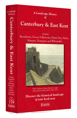
- Canterbury and East Kent 1816-1921 (3-map set)
- Map No. 179, Canterbury and East Kent 1816-1921 (3-map set), in the Cassini Historical Series of old Ordnance Survey mapping of England and Wales at 1:50,000 in a format designed to offer a convenient comparison with the present day coverage from the OS, and most locations in three different editions. Old historical maps have been combined so... Read more
Stanfords
United Kingdom
- Thetford and Diss 1901
- Map No. 144, Thetford and Diss 1901, in the Cassini Historical Series of old Ordnance Survey mapping of England and Wales at 1:50,000 in a format designed to offer a convenient comparison with the present day coverage from the OS, and most locations in three different editions. Old historical maps have been combined so that the sheet lines... Read more
Stanfords
United Kingdom
- Presteigne and Hay-on-Wye / Llanandras a’r Gelli Gandryll 1919-1920
- Map No. 148, Presteigne and Hay-on-Wye / Llanandras a’r Gelli Gandryll 1819-1920, in the Cassini Historical Series of old Ordnance Survey mapping of England and Wales at 1:50,000 in a format designed to offer a convenient comparison with the present day coverage from the OS, and most locations in three different editions. Old historical maps... Read more
Stanfords
United Kingdom
- Stafford and Telford 1833-1837
- Map No. 127, Stafford and Telford 1833-1837, in the Cassini Historical Series of old Ordnance Survey mapping of England and Wales at 1:50,000 in a format designed to offer a convenient comparison with the present day coverage from the OS, and most locations in three different editions. Old historical maps have been combined so that the sheet... Read more
Stanfords
United Kingdom
- Barnard Castle and Richmond 1903-1904
- Map No. 92, Barnard Castle and Richmond 1903-1904, in the Cassini Historical Series of old Ordnance Survey mapping of England and Wales at 1:50,000 in a format designed to offer a convenient comparison with the present day coverage from the OS, and most locations in three different editions. Old historical maps have been combined so that the... Read more