
Alabama
Description
State in the South, bordering on the Gulf of Mexico. Mainly plains, with mountains in the north. Two main trails: The 250 mile Pinhoti Trail (also in Georgia) and the 1600 mile Great Eastern Trail. Several National Forests with good hiking opportunities.
Map

Trails in this state
Links
Facts
Reports
Guides and maps
Lodging
Organisations
Tour operators
GPS
Other
Books

Stanfords
United Kingdom
2015
United Kingdom
2015
- Azores: Car Tours and Walks
- The Azores in the Sunflower Landscapes guide series; exploring the best walking and touring possibilities in the region or area. Detailed information about touring by hired car or public transport, as well as on foot, is provided, helping walkers to navigate and plan day-trips. Shorter strolls are also included as an alternative for each main... Read more

Stanfords
United Kingdom
United Kingdom
- DK Eyewitness Sicily
- Your journey starts here. Featuring DK`s much-loved maps and illustrations, walks and information, plus all new, full-colour photography, this 100% updated guide to Sicily brings you the best of this beautiful island in a brand-new, lightweight format.What`s inside?- full-colour photography, hand-drawn illustrations, and maps throughout-... Read more

Stanfords
United Kingdom
United Kingdom
- DK Eyewitness Amsterdam
- Welcome to Amsterdam - a city where the past and present collide.Whether you want to cruise the reflective waterways, wonder at the works of the Old Masters in the Rijksmuseum, or cycle through the Bulbfields, your DK Eyewitness travel guide makes sure you experience all that Amsterdam has to offer.Rich in heritage, Amsterdam`s perfectly... Read more

Stanfords
United Kingdom
2015
United Kingdom
2015
- Paxos: Car Tours and Walks
- Paxos is the Sunflower Landscapes guide to exploring the best walking and touring possibilities on the island. The guide covers a range of routes including walks in Gaios, Bogdanatika, Loggos, Lakka and Antixpaxos. A double-sided, fold-out touring map at the back of the book gives an overview of the island and the location of each walk.... Read more

Stanfords
United Kingdom
United Kingdom
- DK Eyewitness Rome
- Discover Rome - a feast for the eyes, soul and stomach.Whether you want to wander through the ruins of the Roman Forum, gaze up at the spectacular ceiling of the Sistine Chapel or taste the world-famous food in the markets of Campo de` Flori, your DK Eyewitness travel guide makes sure you experience all that Rome has to offer. An eternal city... Read more

Stanfords
United Kingdom
2020
United Kingdom
2020
- DK Eyewitness Chile and Easter Island
- Venture to Chile - a diverse landscape of vibrant towns and natural wondersWhether you want to hike the spectacular peaks of Torres del Paine, go stargazing in San Pedro de Atacama or relax with world-class wine in the Central Valley, your DK Eyewitness travel guide makes sure you experience all that Chile and Easter Island have to offer.... Read more

Stanfords
United Kingdom
United Kingdom
- DK Eyewitness Lisbon
- Discover Europe`s capital of cool.Whether you want to explore the jumbled streets of Alfama, take in the fantastic views from Castelo de Sao Jorge, or sample the city`s iconic custard tarts at Belem, your DK Eyewitness travel guide makes sure you experience all that Lisbon has to offer.As one of the world`s oldest cities, Lisbon`s colourful... Read more

Stanfords
United Kingdom
United Kingdom
- Moon Nashville (Fourth Edition)
- Move to the beat and savour the unique creative energy of Music City. From hot chicken to warm Southern hospitality, you can experience it all with Moon Nashville. *Explore the City: Navigate by neighborhood or by activity with colour-coded maps, or follow one of our self-guided neighbourhood walks*See the Sites: Watch... Read more
Stanfords
United Kingdom
United Kingdom
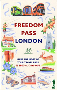
- Freedom Pass London
- Since its creation over 40 years ago, London`s Freedom Pass concessionary travel scheme has continued to grow in popularity and there are now over 1 million registered holders. Whether a fruit picker or forager, a rambler or angler, or simply someone who enjoys the quirky charm of a local pub, Bradt`s new Freedom Pass is the perfect read to... Read more

Stanfords
United Kingdom
United Kingdom
- DK Eyewitness Greece, Athens and the Mainland 7/5/20
- Discover ancient worlds in a spectacular landscape Whether you want to explore the awe inspiring Acropolis, relax on the unspoiled beaches of the Mani archipelago or simply indulge in deliciously fresh Greek food, your DK Eyewitness travel guide makes sure you experience all that Greece has to offer.From the ancient wonders of Delphi and... Read more

Stanfords
United Kingdom
United Kingdom
- DK Eyewitness Travel Guide New Orleans
- Your journey starts here. Featuring DK`s much-loved maps and illustrations, walks and information, plus all new, full-colour photography, this 100% updated guide to New Orleans brings you the best of this lively city in a brand-new, lightweight format.What`s inside?- full-colour photography, hand-drawnillustrations, and maps throughout-... Read more

Stanfords
United Kingdom
United Kingdom
- DK Eyewitness Travel Guide: London
- The ideal travel companion, full of insider advice on what to see and do, plus detailed itineraries and comprehensive maps for exploring this historic city. This new edition comes complete with five exclusive audio walks to help you get the most from your trip.Explore London`s world-class museums, uncover the city`s history at Westminster Abbey... Read more

Stanfords
United Kingdom
United Kingdom
- Tenerife 8/2012 – REMOVED FROM WEBSITE BECAUSE OF DISTRIBUTION PROBLEMS
- About this series:Landmark Visitors Guides present the reader with a detailed, wide-ranging, and easy-to-read overview of an area, making them not only useful guides while on a trip, but also an ideal way to get acquainted with an area before you go.Each guide offers a wide array of information on history & culture, local colour & character,... Read more

Stanfords
United Kingdom
2021
United Kingdom
2021
- DK Eyewitness New Zealand
- Welcome to New Zealand, the land of the long white cloudWhether you`re seeking your next adrenaline-fix, the best places to learn more about Maori culture, or the perfect geothermal pool to unwind in, your DK Eyewitness travel guide makes sure you experience all that New Zealand has to offer.An explosion of dramatic scenery, this far-flung... Read more
Stanfords
United Kingdom
United Kingdom
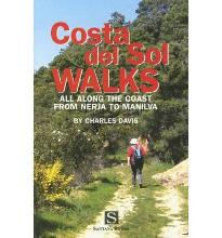
- Costa Del Sol Walks
- Full-color guide to thirty-four walks all within a short distance from the coast, from Nerja to Manilva. With easy-to-follow route notes, full-color maps and clear instructions on how to get to the start of each walk. Read more
Maps

Stanfords
United Kingdom
United Kingdom
- Philim
- Philim, sheet no. 2884-12, in the topographic survey of Nepal at 1:50,000 published by the Nepali Government in the late 1990s and early 2000s and produced from remote sensing data by Finnish cartographers as part of that country’s international aid program. The maps cover 15’ x 15’ quadrangles.IMPORTANT – PLEASE NOTE BEFORE ORDERING:... Read more
Stanfords
United Kingdom
United Kingdom
- Lamjun Himal
- Lamjun Himal, sheet no. 2884-09, in the topographic survey of Nepal at 1:50,000 published by the Nepali Government in the late 1990s and early 2000s and produced from remote sensing data by Finnish cartographers as part of that country’s international aid program. The maps cover 15’ x 15’ quadrangles.IMPORTANT – PLEASE NOTE BEFORE ORDERING:... Read more
Stanfords
United Kingdom
United Kingdom
- Taplejung
- Taplejung, sheet no. 2787-11, in the topographic survey of Nepal at 1:50,000 published by the Nepali Government in the late 1990s and early 2000s and produced from remote sensing data by Finnish cartographers as part of that country’s international aid program. The maps cover 15’ x 15’ quadrangles.IMPORTANT – PLEASE NOTE BEFORE ORDERING:... Read more
Stanfords
United Kingdom
United Kingdom
- Tinje
- Tinje, sheet no. 2983-10, in the topographic survey of Nepal at 1:50,000 published by the Nepali Government in the late 1990s and early 2000s and produced from remote sensing data by Finnish cartographers as part of that country’s international aid program. The maps cover 15’ x 15’ quadrangles.IMPORTANT – PLEASE NOTE BEFORE ORDERING:... Read more
Stanfords
United Kingdom
United Kingdom
- Lukla - Salleri
- Lukla - Salleri, sheet no. 2786-07, in the topographic survey of Nepal at 1:50,000 published by the Nepali Government in the late 1990s and early 2000s and produced from remote sensing data by Finnish cartographers as part of that country’s international aid program. The maps cover 15’ x 15’ quadrangles.IMPORTANT – PLEASE NOTE BEFORE ORDERING:... Read more
Stanfords
United Kingdom
United Kingdom
- Takagau
- Takagau, sheet no. 2882-08, in the topographic survey of Nepal at 1:50,000 published by the Nepali Government in the late 1990s and early 2000s and produced from remote sensing data by Finnish cartographers as part of that country’s international aid program. The maps cover 15’ x 15’ quadrangles.IMPORTANT – PLEASE NOTE BEFORE ORDERING:... Read more
Stanfords
United Kingdom
United Kingdom
- Yanma
- Yamna, sheet no. 2787-04, in the topographic survey of Nepal at 1:50,000 published by the Nepali Government in the late 1990s and early 2000s and produced from remote sensing data by Finnish cartographers as part of that country’s international aid program. The maps cover 15’ x 15’ quadrangles.IMPORTANT – PLEASE NOTE BEFORE ORDERING:... Read more
Stanfords
United Kingdom
United Kingdom
- Rachuli
- Rachuli, sheet no. 2981-16, in the topographic survey of Nepal at 1:50,000 published by the Nepali Government in the late 1990s and early 2000s and produced from remote sensing data by Finnish cartographers as part of that country’s international aid program. The maps cover 15’ x 15’ quadrangles.IMPORTANT – PLEASE NOTE BEFORE ORDERING:... Read more
Stanfords
United Kingdom
United Kingdom
- Tiptala Bhañjyan
- Tiptala Bhanjyan, sheet no. 2787-03, in the topographic survey of Nepal at 1:50,000 published by the Nepali Government in the late 1990s and early 2000s and produced from remote sensing data by Finnish cartographers as part of that country’s international aid program. The maps cover 15’ x 15’ quadrangles.IMPORTANT – PLEASE NOTE BEFORE ORDERING:... Read more
Stanfords
United Kingdom
United Kingdom
- Europe High 5 Edition Road Atlas
- The first physical atlas with direct access to useful additional information from the InternetThe entirety of Europe on 432 pages in a scale of 1:800,000 clearly presented, including lots more travel information:- Road Companion (roadmaps) in a scale of 1:800,000, inclusive of the High 5 - Edition app technology for calling up additional travel... Read more
Stanfords
United Kingdom
United Kingdom
- Samagau
- Samagau, sheet no. 2884-07, in the topographic survey of Nepal at 1:50,000 published by the Nepali Government in the late 1990s and early 2000s and produced from remote sensing data by Finnish cartographers as part of that country’s international aid program. The maps cover 15’ x 15’ quadrangles.IMPORTANT – PLEASE NOTE BEFORE ORDERING:... Read more
Stanfords
United Kingdom
United Kingdom
- Panlham
- Panlham, sheet no. 2983-12, in the topographic survey of Nepal at 1:50,000 published by the Nepali Government in the late 1990s and early 2000s and produced from remote sensing data by Finnish cartographers as part of that country’s international aid program. The maps cover 15’ x 15’ quadrangles.IMPORTANT – PLEASE NOTE BEFORE ORDERING:... Read more
Stanfords
United Kingdom
United Kingdom
- Ghunsa Khola - Olanchungola
- Ghunsa Khola - Olanchungola, sheet no. 2787-08, in the topographic survey of Nepal at 1:50,000 published by the Nepali Government in the late 1990s and early 2000s and produced from remote sensing data by Finnish cartographers as part of that country’s international aid program. The maps cover 15’ x 15’ quadrangles.IMPORTANT – PLEASE NOTE... Read more
Stanfords
United Kingdom
United Kingdom
- Mukot
- Mukot, sheet no. 2883-02, in the topographic survey of Nepal at 1:50,000 published by the Nepali Government in the late 1990s and early 2000s and produced from remote sensing data by Finnish cartographers as part of that country’s international aid program. The maps cover 15’ x 15’ quadrangles.IMPORTANT – PLEASE NOTE BEFORE ORDERING:... Read more
Stanfords
United Kingdom
United Kingdom
- Mt. Everest (Sagarmatha) - Hinku Himal
- Mount Everesr (Sagarmatha) - Hinku Himal, sheet no. 2786-04, in the topographic survey of Nepal at 1:50,000 published by the Nepali Government in the late 1990s and early 2000s and produced from remote sensing data by Finnish cartographers as part of that country’s international aid program. The maps cover 15’ x 15’ quadrangles.IMPORTANT –... Read more