
Canadian Rockies
Description
The Canadian segment of the North American Rocky Mountains range, the eastern part of the Canadian Cordillera.
Trails in this region
Links
Facts
Reports
Guides and maps
Lodging
Organisations
Tour operators
GPS
Other
Books

Stanfords
United Kingdom
United Kingdom
- Best of Canmore Gem Trek
- Best of Camnore, a contoured and GPS compatible, waterproof and tear-resistant map/guide at 1:35,000 from Gem Trek, designed for people who are only going to be in Camnore for one to three days and want to know the highlights. On one side is a detailed, relief-shaded topographic map of the Canmore area, covering Canmore Nordic Centre Provincial... Read more

Stanfords
United Kingdom
United Kingdom
- Kootenay National Park Gem Trek Map
- Kootenay National Park in the Canadian Rockies at 1:100,000 on a contoured and GPS compatible, waterproof and tear-resistant map from Gem Trek Publishing, highlighting hiking trails, recreational areas, accommodation options, etc, plus on the reverse extensive tourist information including descriptions of recommended routes.The map provides a... Read more

Bol.com
Netherlands
2018
Netherlands
2018
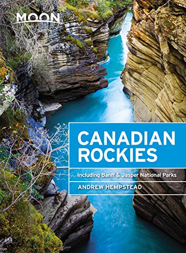
- Moon Canadian Rockies (Ninth Edition)
- Find Your Adventure in the Canadian Rockies with Moon Travel Guides! Snowy peaks, icy glaciers, glittering lakes, and alpine meadows: answer the call of the wild with Moon Canadian Rockies. What's inside Moon Canadian Rockies: * Strategic Itineraries in an easy-to-navigate format, such as Best of the Canadian Rockies , Top 12 Day Hikes, Family... Read more
- Also available from:
- Bol.com, Belgium
Bol.com
Belgium
2018
Belgium
2018
- Moon Canadian Rockies (Ninth Edition)
- Find Your Adventure in the Canadian Rockies with Moon Travel Guides! Snowy peaks, icy glaciers, glittering lakes, and alpine meadows: answer the call of the wild with Moon Canadian Rockies. What's inside Moon Canadian Rockies: * Strategic Itineraries in an easy-to-navigate format, such as Best of the Canadian Rockies , Top 12 Day Hikes, Family... Read more
Bol.com
Netherlands
Netherlands
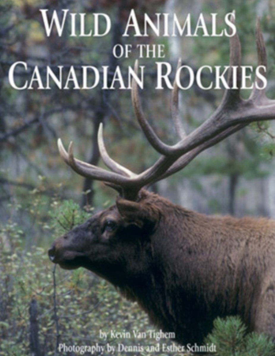
- Wild Animals of the Canadian Rockies
- The animals of the Canadian Rockies are legendary throughout the world for their grandeur, mystique and beauty. This stunning picture book highlights dozens of species and contains basic information on the habitats of bears, wolves, deer, elk, moose, bighorn sheep, mountain goats, caribou and many more. Read more
- Also available from:
- Bol.com, Belgium
Bol.com
Belgium
Belgium
- Wild Animals of the Canadian Rockies
- The animals of the Canadian Rockies are legendary throughout the world for their grandeur, mystique and beauty. This stunning picture book highlights dozens of species and contains basic information on the habitats of bears, wolves, deer, elk, moose, bighorn sheep, mountain goats, caribou and many more. Read more
Bol.com
Netherlands
Netherlands
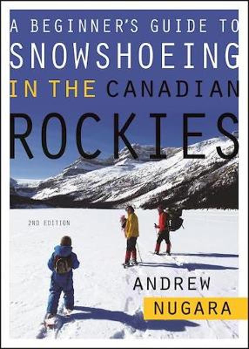
- A Beginner's Guide to Snowshoeing in the Canadian Rockies
- Snowshoeing in the Canadian Rockies 2nd Edition describes 100+ great routes for snowshoers of all levels from beginners who have never snowshoed, to experienced backcountry travelers who are looking for new challenges. The 61 routes described in the first edition have been augmented with 45 new routes, including trips in the Crowsnest Pass and... Read more
- Also available from:
- Bol.com, Belgium
Bol.com
Belgium
Belgium
- A Beginner's Guide to Snowshoeing in the Canadian Rockies
- Snowshoeing in the Canadian Rockies 2nd Edition describes 100+ great routes for snowshoers of all levels from beginners who have never snowshoed, to experienced backcountry travelers who are looking for new challenges. The 61 routes described in the first edition have been augmented with 45 new routes, including trips in the Crowsnest Pass and... Read more
Bol.com
Netherlands
Netherlands
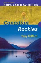
- Popular Day Hikes 2
- Featuring a fresh design and the most recent route updates, Popular Day Hikes is a series of bestselling books written for visitors and locals looking to hike scenic trails from well-established staging areas.Popular Day Hikes 2 covers 37 popular, accessible trails in one of the world s most stunningly beautiful natural environments. Featuring... Read more
- Also available from:
- Bol.com, Belgium
Bol.com
Belgium
Belgium
- Popular Day Hikes 2
- Featuring a fresh design and the most recent route updates, Popular Day Hikes is a series of bestselling books written for visitors and locals looking to hike scenic trails from well-established staging areas.Popular Day Hikes 2 covers 37 popular, accessible trails in one of the world s most stunningly beautiful natural environments. Featuring... Read more
Bol.com
Netherlands
Netherlands
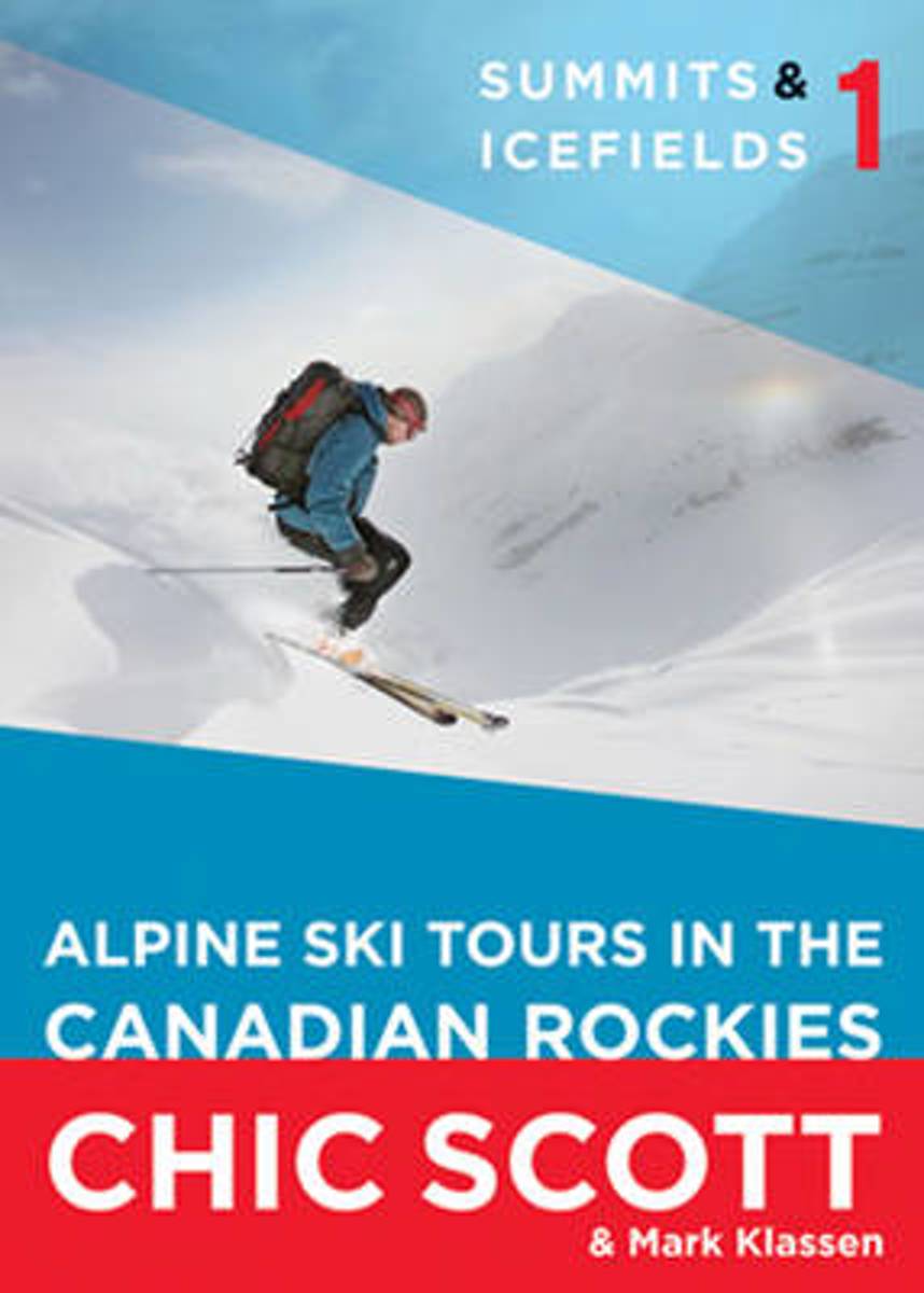
- Summits & Icefields 1
- RMB is pleased to present the third edition of Summits and Icefields 1: Alpine Ski Tours in the Canadian Rockies, one of our bestselling guidebooks. Researched and written by legendary alpinist Chic Scott, with the assistance of mountain guide Mark Klassen, this guidebook will continue to be the bible of ski mountaineers in the Rockies. There... Read more
- Also available from:
- Bol.com, Belgium
Bol.com
Belgium
Belgium
- Summits & Icefields 1
- RMB is pleased to present the third edition of Summits and Icefields 1: Alpine Ski Tours in the Canadian Rockies, one of our bestselling guidebooks. Researched and written by legendary alpinist Chic Scott, with the assistance of mountain guide Mark Klassen, this guidebook will continue to be the bible of ski mountaineers in the Rockies. There... Read more
Bol.com
Netherlands
Netherlands
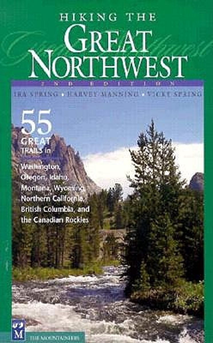
- Hiking the Great Northwest
- * Highlights the most spectacular trails in six states and two provinces * Personal picks of a trail-tested team of Northwest hiking icons Hiking the Great Nothwest is a collection of classic hikes and trails in the Pacific Northwest, as selected by the late godfathers of Northwest hiking, Ira Spring and Harvey Manning. Hikes in Washington's... Read more
- Also available from:
- Bol.com, Belgium
Bol.com
Belgium
Belgium
- Hiking the Great Northwest
- * Highlights the most spectacular trails in six states and two provinces * Personal picks of a trail-tested team of Northwest hiking icons Hiking the Great Nothwest is a collection of classic hikes and trails in the Pacific Northwest, as selected by the late godfathers of Northwest hiking, Ira Spring and Harvey Manning. Hikes in Washington's... Read more
Bol.com
Netherlands
2002
Netherlands
2002
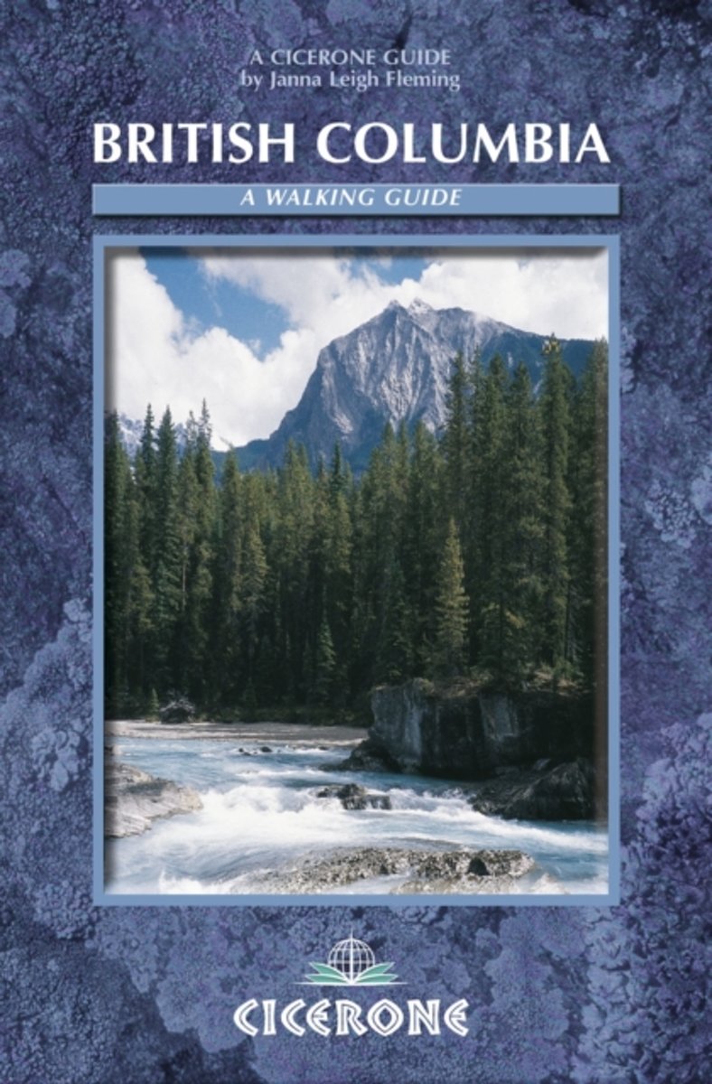
- British Columbia
- British Columbia is vast, four times the size of the UK, with only 3.5 million people, most of them in Vancouver. From the heights of the Canadian Rockies to the awesome Pacific coast, it contains a wide range of peoples, terrain and opportunities for real exploration. The Canadian wilderness gives meaning to the words pristine and rugged. With... Read more
- Also available from:
- Bol.com, Belgium
Bol.com
Belgium
2002
Belgium
2002
- British Columbia
- British Columbia is vast, four times the size of the UK, with only 3.5 million people, most of them in Vancouver. From the heights of the Canadian Rockies to the awesome Pacific coast, it contains a wide range of peoples, terrain and opportunities for real exploration. The Canadian wilderness gives meaning to the words pristine and rugged. With... Read more
Bol.com
Netherlands
Netherlands
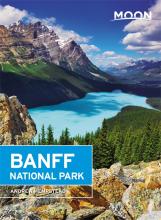
- Moon Banff National Park (Second Edition)
- Find Your Adventure with Moon Travel Guides!Banff sparkles as the crown jewel of Canada's national parks. Explore the best of it with Moon Banff National Park.Inside you'll find:Strategies for getting to Banff National Park by car or planeIn-depth chapters on each region of the parkand its surroundings, including the town of Banff, Lake Louise... Read more
- Also available from:
- Bol.com, Belgium
Bol.com
Belgium
Belgium
- Moon Banff National Park (Second Edition)
- Find Your Adventure with Moon Travel Guides!Banff sparkles as the crown jewel of Canada's national parks. Explore the best of it with Moon Banff National Park.Inside you'll find:Strategies for getting to Banff National Park by car or planeIn-depth chapters on each region of the parkand its surroundings, including the town of Banff, Lake Louise... Read more
Bol.com
Netherlands
Netherlands
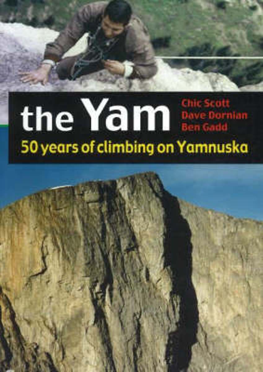
- The Yam
- Recipient of the Banff Mountain Book Festival's Canadian Rockies AwardThe great wall of stone rising so prominently above the Trans-Canada Highway between Calgary and Banff, is the birthplace of modern rockclimbing in the Canadian Rockies. It was 50 years ago in 1952 that Hans Gmoser and Leo Grillmair first took up the challenge. Since then Yam... Read more
- Also available from:
- Bol.com, Belgium
Bol.com
Belgium
Belgium
- The Yam
- Recipient of the Banff Mountain Book Festival's Canadian Rockies AwardThe great wall of stone rising so prominently above the Trans-Canada Highway between Calgary and Banff, is the birthplace of modern rockclimbing in the Canadian Rockies. It was 50 years ago in 1952 that Hans Gmoser and Leo Grillmair first took up the challenge. Since then Yam... Read more
Bol.com
Netherlands
Netherlands
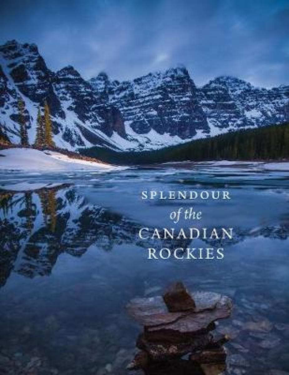
- Splendour of the Canadian Rockies
- In celebration of the 150th anniversary of Canadian Confederation and in conjunction with Parks Canadas announcement that entrance to all of Canadas national parks, national historic sites and national marine conservation areas will be free throughout 2017, RMB is excited to launch an entirely new series of photography books created and... Read more
- Also available from:
- Bol.com, Belgium
Bol.com
Belgium
Belgium
- Splendour of the Canadian Rockies
- In celebration of the 150th anniversary of Canadian Confederation and in conjunction with Parks Canadas announcement that entrance to all of Canadas national parks, national historic sites and national marine conservation areas will be free throughout 2017, RMB is excited to launch an entirely new series of photography books created and... Read more

Stanfords
United Kingdom
United Kingdom
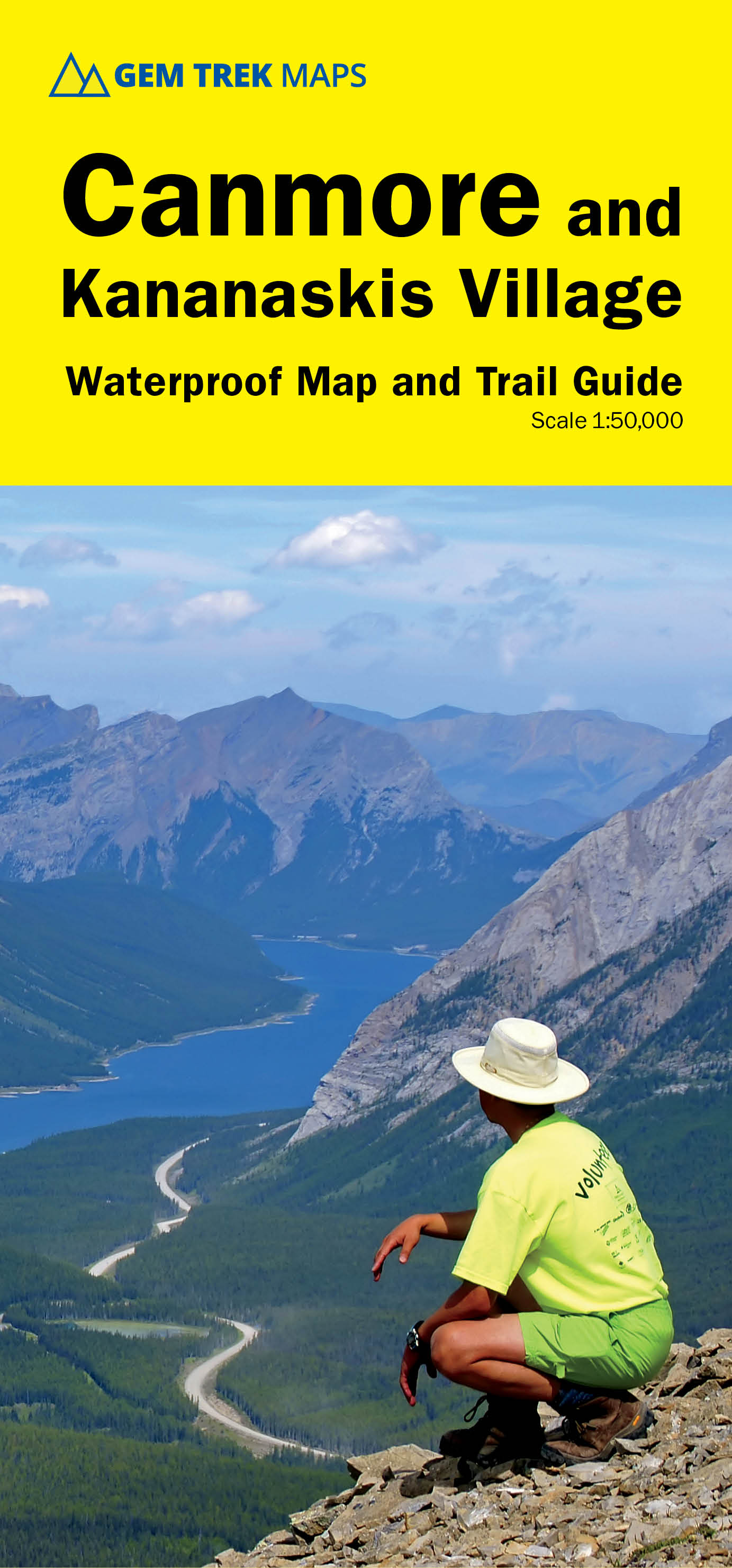
- Canmore and Kananaskis Village Gem Trek
- Canmore and Kananaskis Village area of the Canadian Rockies on a contoured and GPS compatible, waterproof and tear-resistant map at 1:50,000 from Gem Trek with an enlargement of the Kananaskis Village, descriptions of recommended trails and other tourist information.The map covers some of the most popular terrain for hikers and mountain bikers... Read more
- Also available from:
- De Zwerver, Netherlands
De Zwerver
Netherlands
Netherlands
- Wandelkaart 06 Canmore & Kananaskis Village | Gem Trek Maps
- Canmore and Kananaskis Village area of the Canadian Rockies on a contoured and GPS compatible, waterproof and tear-resistant map at 1:50,000 from Gem Trek with an enlargement of the Kananaskis Village, descriptions of recommended trails and other tourist information.The map covers some of the most popular terrain for hikers and mountain bikers... Read more
Bol.com
Netherlands
Netherlands
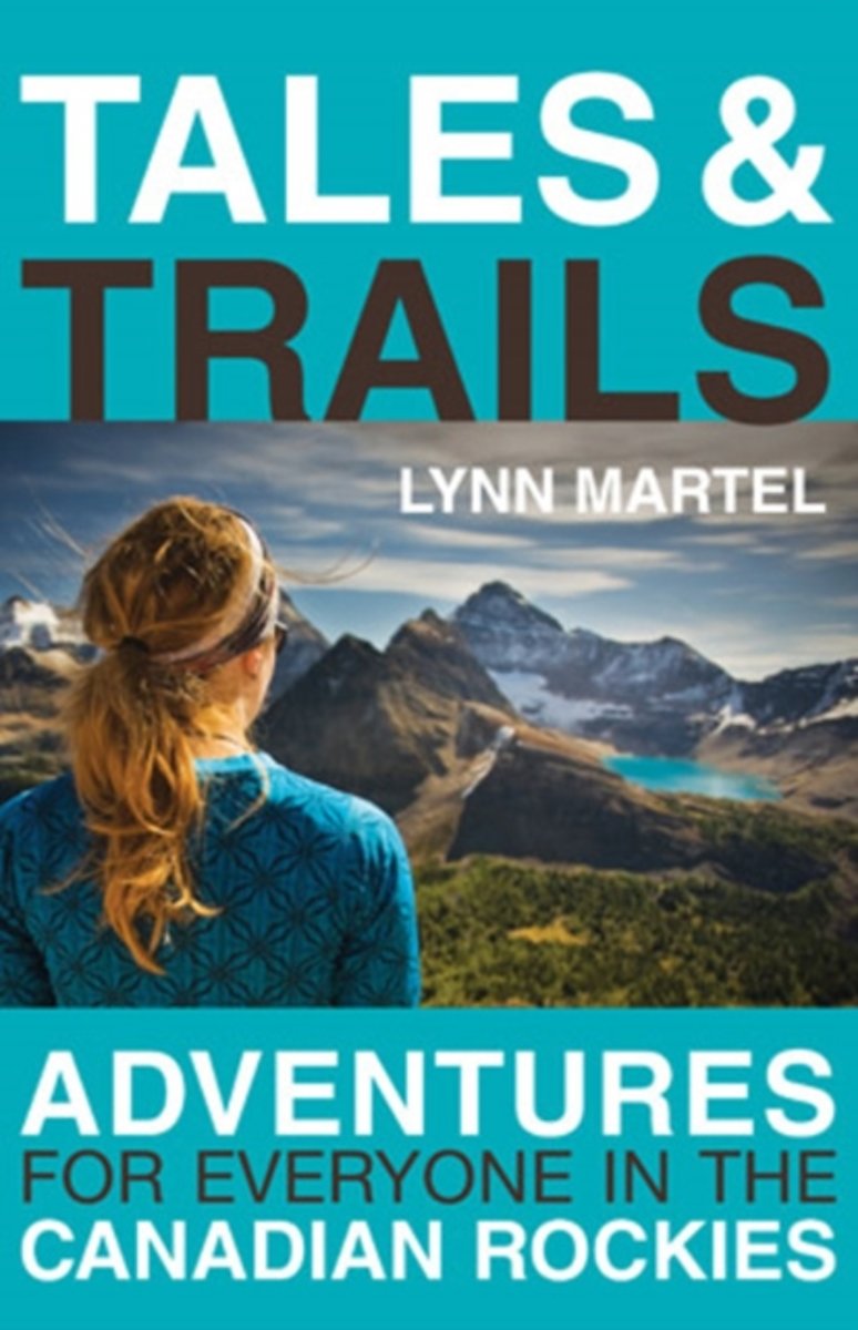
- Tales and Trails
- Since moving to the Rockies of western Canada in 1984, Lynn Martel has spent countless hours and days exploring the mountain wilderness with her many experienced friends as well as some of the best known and well-informed professional guides in the outdoor adventure business. Waking up in tents and backcountry huts; hiking and skiing up... Read more
- Also available from:
- Bol.com, Belgium
Bol.com
Belgium
Belgium
- Tales and Trails
- Since moving to the Rockies of western Canada in 1984, Lynn Martel has spent countless hours and days exploring the mountain wilderness with her many experienced friends as well as some of the best known and well-informed professional guides in the outdoor adventure business. Waking up in tents and backcountry huts; hiking and skiing up... Read more
Maps

Stanfords
United Kingdom
United Kingdom
- Tweedsmuir Provincial Park ITMB
- Tweedsmuir Provincial Park at 1:250,000 in a series of topographic survey maps of selected areas of British Columbia and the Canadian Rockies from ITMB with cartography from Canada’s national survey organization. Most sheets are printed on light, waterproof and tear- resistant plastic paper.Whilst the Canadian Department of Natural Resources... Read more

Stanfords
United Kingdom
United Kingdom
- Bowron Lakes Canoe Route ITMB
- Bowron Lakes Canoe Route at 1:50,000 in a series of topographic survey maps of selected areas of British Columbia and the Canadian Rockies from ITMB with cartography from Canada’s national survey organization. Most sheets are printed on light, waterproof and tear- resistant plastic paper.Whilst the Canadian Department of Natural Resources... Read more

Stanfords
United Kingdom
United Kingdom
- Manning Park - Skagit River ITMB
- Manning Park - Skagit River at 1:50,000 in a series of topographic survey maps of selected areas of British Columbia and the Canadian Rockies from ITMB with cartography from Canada’s national survey organization. Most sheets are printed on light, waterproof and tear- resistant plastic paper.Whilst the Canadian Department of Natural Resources... Read more

Stanfords
United Kingdom
United Kingdom
- Garibaldi Provincial Park ITMB
- Garibaldi Provincial Park at 1:50,000 in a series of topographic survey maps of selected areas of British Columbia and the Canadian Rockies from ITMB with cartography from Canada’s national survey organization. Most sheets are printed on light, waterproof and tear- resistant plastic paper.Whilst the Canadian Department of Natural Resources... Read more
Stanfords
United Kingdom
United Kingdom
- North Vancouver - Port Coquitlam ITMB
- North Vancouver - Port Coquitlam at 1:50,000 in a series of topographic survey maps of selected areas of British Columbia and the Canadian Rockies from ITMB with cartography from Canada’s national survey organization. Most sheets are printed on light, waterproof and tear- resistant plastic paper.Whilst the Canadian Department of Natural... Read more

Stanfords
United Kingdom
United Kingdom
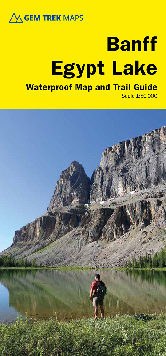
- Banff - Egypt Lake Gem Trek
- Banff - Egypt Lake, a contoured and GPS compatible map at 1:50,000 from Gem Trek of the main hiking area in the Banff National Park, with coverage around Banff itself, including trails eastwards to Lake Minnewanka and Johnson, and extending westwards across the state border to include parts of Kootenay NP and Mt. Assiniboine Provincial Park.... Read more
Stanfords
United Kingdom
United Kingdom
- Revelstoke National Park ITMB
- Revelstoke National Park at 1:50,000 in a series of topographic survey maps of selected areas of British Columbia and the Canadian Rockies from ITMB with cartography from Canada’s national survey organization. Most sheets are printed on light, waterproof and tear- resistant plastic paper.Whilst the Canadian Department of Natural Resources... Read more

Stanfords
United Kingdom
United Kingdom
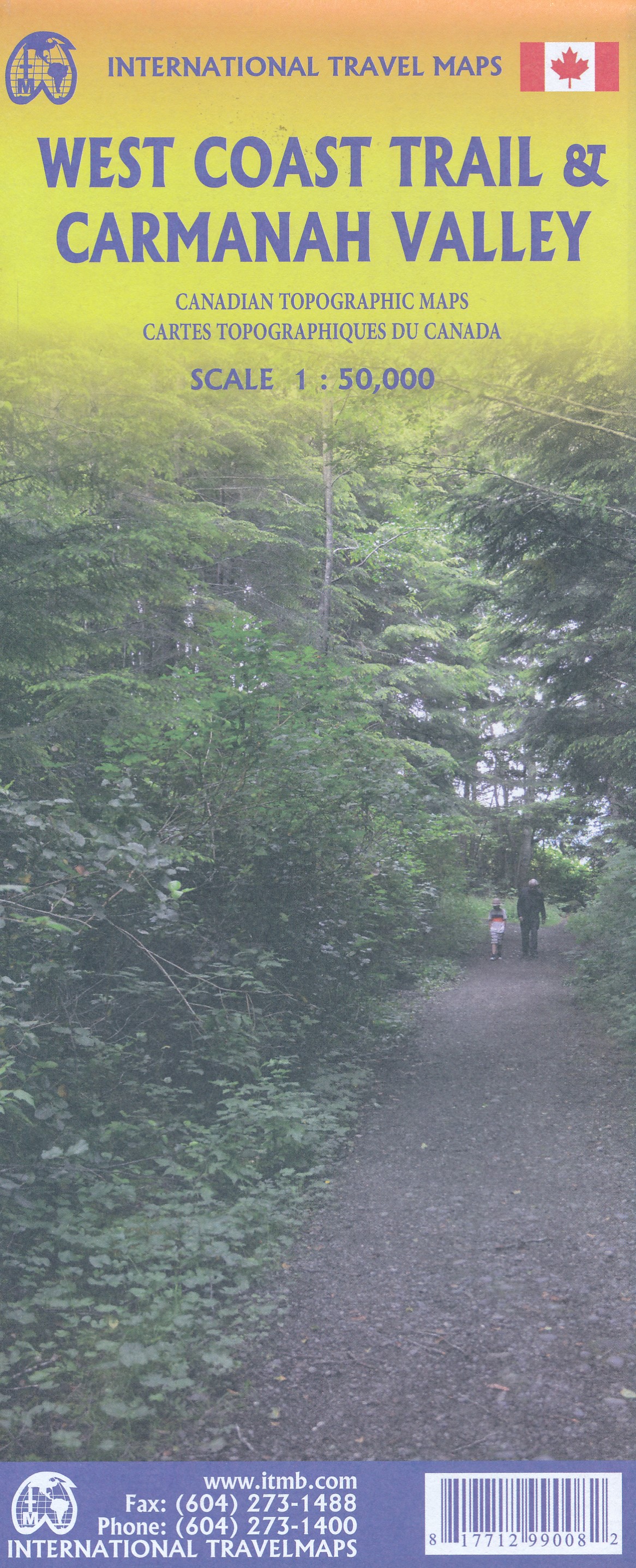
- West Coast Trail & Carmanah Valley ITMB
- West Coast Trail in the Pacific Rim National Park Reserve and the Carmanah Valley in the Carmanah Walbran Provincial Park on the western coast of Vancouver Island at 1:50,000 in a series of topographic survey maps of selected areas of British Columbia and the Canadian Rockies from ITMB with cartography from Canada’s national survey... Read more
- Also available from:
- The Book Depository, United Kingdom
- De Zwerver, Netherlands

The Book Depository
United Kingdom
United Kingdom
- West Coast Trail / Carmanah Valley
- West Coast Trail in the Pacific Rim National Park Reserve and the Carmanah Valley in the Carmanah Walbran Provincial Park on the western coast of Vancouver Island at 1:50,000 in a series of topographic survey maps of selected areas of British Columbia and the Canadian Rockies from ITMB with cartography from Canada’s national survey... Read more
De Zwerver
Netherlands
Netherlands
- Wandelkaart West Coast Trail & Carmanah Valley | ITMB
- West Coast Trail in the Pacific Rim National Park Reserve and the Carmanah Valley in the Carmanah Walbran Provincial Park on the western coast of Vancouver Island at 1:50,000 in a series of topographic survey maps of selected areas of British Columbia and the Canadian Rockies from ITMB with cartography from Canada’s national survey... Read more

Stanfords
United Kingdom
United Kingdom
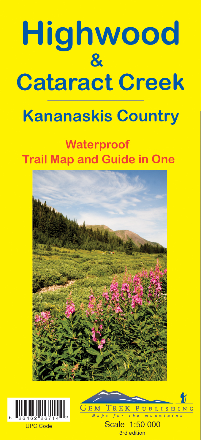
- Highwood & Cataract Creek - Kananaskis Country Gem Trek Map
- Highwood and Cataract Creek area of the Canadian Rockies on a contoured and GPS compatible, waterproof and tear-resistant map at 1:50,000 from Gem Trek with descriptions of recommended trails and other tourist information. On the reverse an inset at 1:50 000 extends the coverage south to take in the trails accessed from Highways 940 and 542,... Read more
- Also available from:
- De Zwerver, Netherlands
De Zwerver
Netherlands
Netherlands
- Wandelkaart 09 Highwood & Cataract Creek | Gem Trek Maps
- Highwood and Cataract Creek area of the Canadian Rockies on a contoured and GPS compatible, waterproof and tear-resistant map at 1:50,000 from Gem Trek with descriptions of recommended trails and other tourist information. On the reverse an inset at 1:50 000 extends the coverage south to take in the trails accessed from Highways 940 and 542,... Read more

Stanfords
United Kingdom
United Kingdom
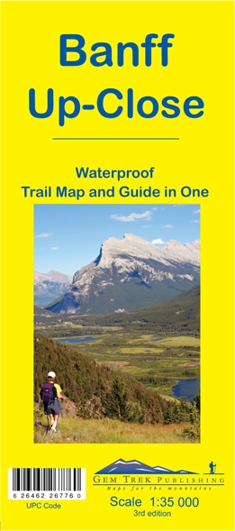
- Banff Up-Close Gem Trek
- Banff town and the surrounding area on a contoured and GPS compatible, waterproof and tear-resistant map/guide at 1:35,000 from Gem Trek, designed for people who are only going to be in Banff for one to three days and want to know the highlights. On one side is a detailed, topographic map of the Banff village area, from the Sundance and Sulphur... Read more
- Also available from:
- De Zwerver, Netherlands
De Zwerver
Netherlands
Netherlands
- Wandelkaart 11 Banff Up-Close | Gem Trek Maps
- Gem Trek Map-Guides Banff Up-Close (11) - This map-and-guide-in-one is designed for people who are only going to be in Banff for one to three days, and want to know what the highlights are and how to find them.On the front is a detailed relief-shaded topographic map of the Banff townsite area, from the Sundance and Sulphur Mountain areas in the... Read more
Stanfords
United Kingdom
2008
United Kingdom
2008
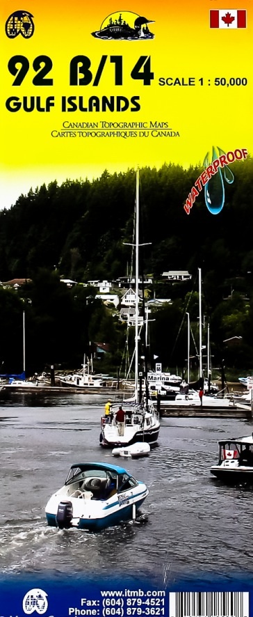
- Gulf Islands - Nanaimo and Islands ITMB
- Gulf Islands - Nanaimo and Islands at 1:50,000 in a series of topographic survey maps of selected areas of British Columbia and the Canadian Rockies from ITMB with cartography from Canada’s national survey organization. Most sheets are printed on light, waterproof and tear- resistant plastic paper.Whilst the Canadian Department of Natural... Read more
- Also available from:
- De Zwerver, Netherlands
De Zwerver
Netherlands
2008
Netherlands
2008
- Wegenkaart - landkaart Gulf Islands & Nanaimo (Canada) | ITMB
- Gulf Islands - Nanaimo and Islands at 1:50,000 in a series of topographic survey maps of selected areas of British Columbia and the Canadian Rockies from ITMB with cartography from Canada Read more

Stanfords
United Kingdom
United Kingdom
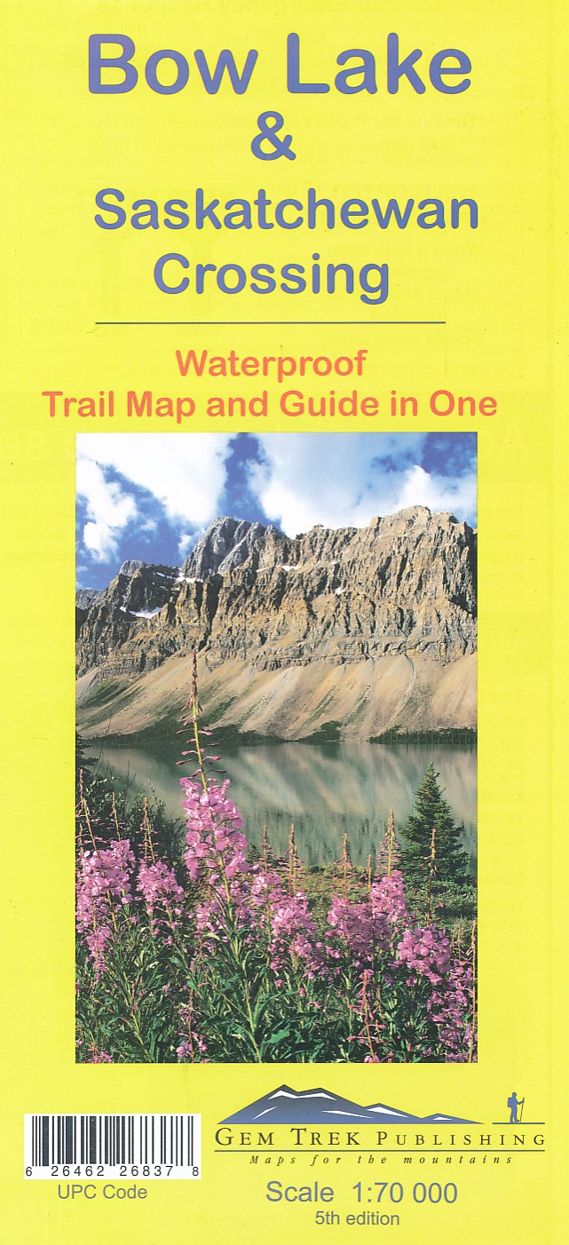
- Bow Lake & Saskatchewan Crossing Gem Trek Map
- Bow Lake - Saskatchewan Crossing region of the Canadian Rockies on a contoured and GPS compatible map at 1:70,000 from Gem Trek with an extension at 1:100,000 to include the Mosquito Creek – Fish Lakes area, plus extensive tourist information on recommended hikes, etc.The map shows trails departing from the southern section of the Icefields... Read more
- Also available from:
- De Zwerver, Netherlands
De Zwerver
Netherlands
Netherlands
- Wandelkaart 03 Bow Lake and Saskatchewan Crossing | Gem Trek Maps
- Bow Lake - Saskatchewan Crossing region of the Canadian Rockies on a contoured and GPS compatible map at 1:70,000 from Gem Trek with an extension at 1:100,000 to include the Mosquito Creek – Fish Lakes area, plus extensive tourist information on recommended hikes, etc.The map shows trails departing from the southern section of the Icefields... Read more
Stanfords
United Kingdom
United Kingdom
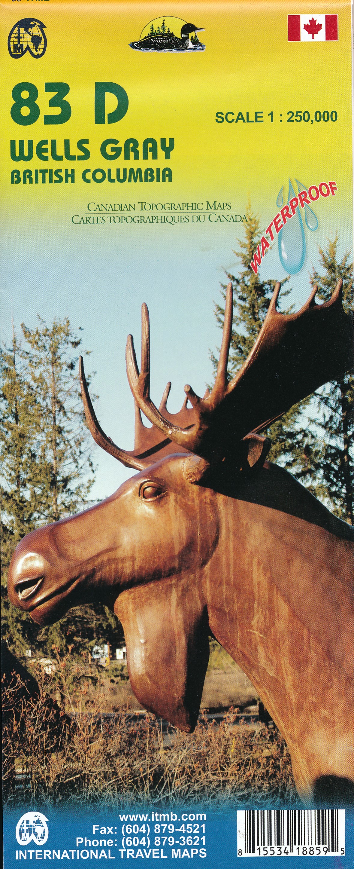
- Wells Gray - Murtle Lake ITMB
- Wells Gray - Murtle Lake at 1:250,000 and 1:50,000 in a series of topographic survey maps of selected areas of British Columbia and the Canadian Rockies from ITMB with cartography from Canada’s national survey organization. Most sheets are printed on light, waterproof and tear- resistant plastic paper.Whilst the Canadian Department of Natural... Read more
- Also available from:
- De Zwerver, Netherlands
De Zwerver
Netherlands
Netherlands
- Wegenkaart - landkaart 83D Wells Gray - Murtle Lake | ITMB
- Wells Gray - Murtle Lake at 1:250,000 and 1:50,000 in a series of topographic survey maps of selected areas of British Columbia and the Canadian Rockies from ITMB with cartography from Canada Read more