
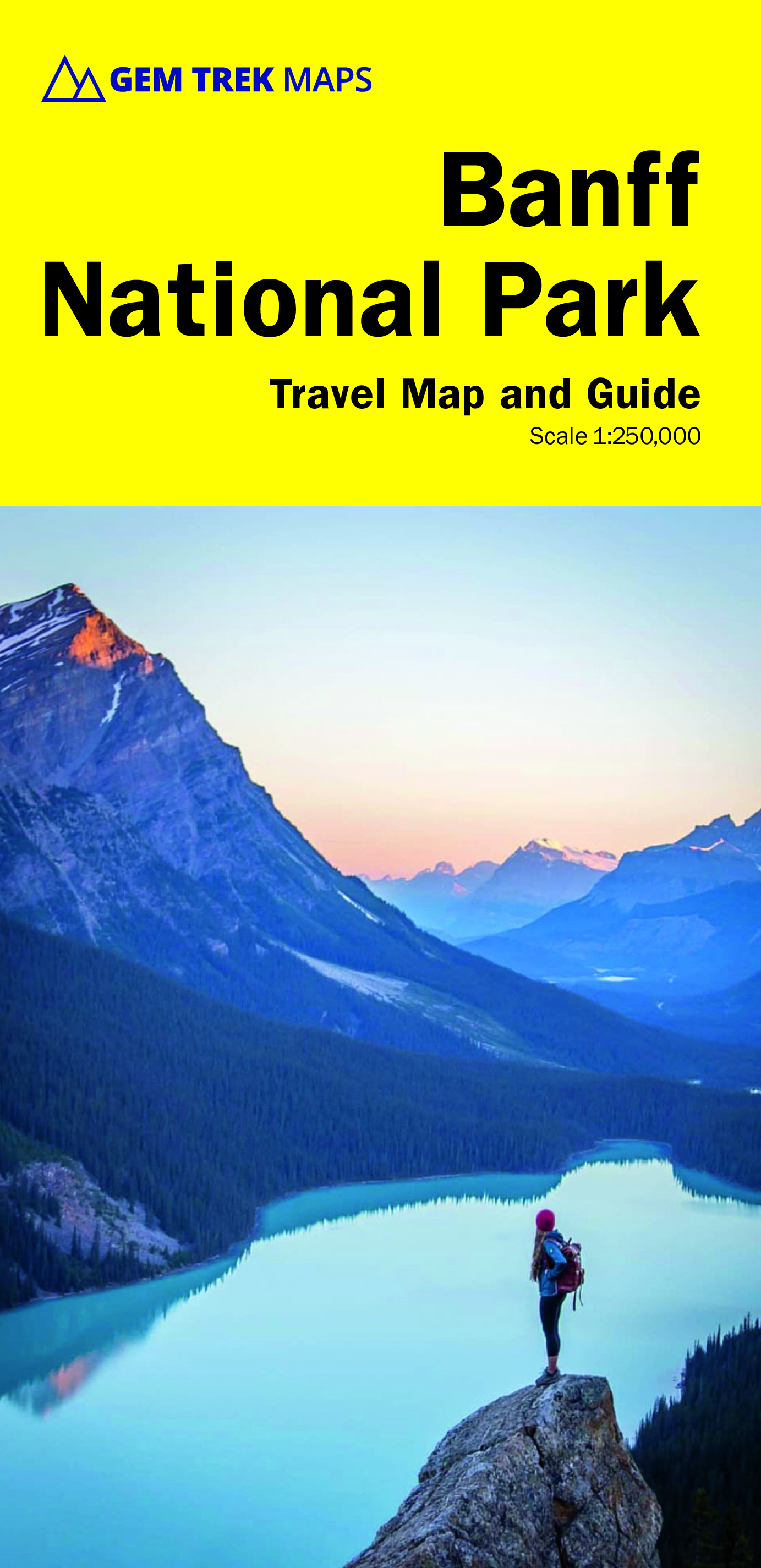
Banff National Park
Description
National Park in the Canadian Rocky Mountains.
Trails in this region
Links
Facts
Reports
Guides and maps
Lodging
Organisations
Tour operators
GPS
Other
Books

Stanfords
United Kingdom
2008
United Kingdom
2008
- 50 Walks and Hikes in Banff National Park
- Hiking in Banff National Park attracts millions of visitors each year. In this book, Brian Patton and Bart Robinson, authors of the best-selling Canadian Rockies Trail Guide, detail their favourite easy walks, short hikes, and day trips in one of the world’s most spectacular national parks. Each trail is described in detail and accompanied by... Read more

Stanfords
United Kingdom
United Kingdom
- Kootenay National Park Gem Trek Map
- Kootenay National Park in the Canadian Rockies at 1:100,000 on a contoured and GPS compatible, waterproof and tear-resistant map from Gem Trek Publishing, highlighting hiking trails, recreational areas, accommodation options, etc, plus on the reverse extensive tourist information including descriptions of recommended routes.The map provides a... Read more

Stanfords
United Kingdom
United Kingdom
- Best of Canmore Gem Trek
- Best of Camnore, a contoured and GPS compatible, waterproof and tear-resistant map/guide at 1:35,000 from Gem Trek, designed for people who are only going to be in Camnore for one to three days and want to know the highlights. On one side is a detailed, relief-shaded topographic map of the Canmore area, covering Canmore Nordic Centre Provincial... Read more

Stanfords
United Kingdom
United Kingdom
- DK Eyewitness Travel Guide Canada
- DK Eyewitness travel guides: award-winning guidebooksDiscover Canada with this essential travel guide, designed to help you create your own unique trip and to transport you to this incredible country before you`ve even packed your case - marvel at the magnificent thundering waterfalls of Niagara Falls, hike through spectacular scenery in Banff... Read more

The Book Depository
United Kingdom
2021
United Kingdom
2021
- Moon Best of Glacier, Banff & Jasper (First Edition)
- Make the Most of One to Three Days in the Parks Read more


Stanfords
United Kingdom
2015
United Kingdom
2015
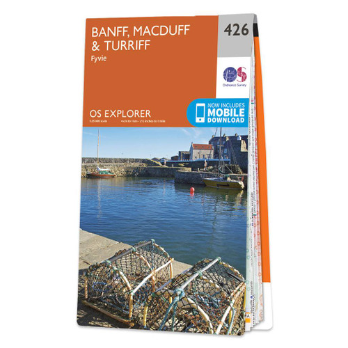
- Banff, Macduff & Turriff - Fyvie OS Explorer Map 426 (paper)
- Banff, Macduff, Turriff and Fyvie area on a detailed topographic and GPS compatible map No. 426, paper version, from the Ordnance Survey’s 1:25,000 Explorer series. MOBILE DOWNLOADS: this title and all the other OS Explorer maps include a code for downloading after purchase the digital version onto your smartphone or tablet for viewing on the... Read more
- Also available from:
- The Book Depository, United Kingdom
- De Zwerver, Netherlands

De Zwerver
Netherlands
2015
Netherlands
2015

The Book Depository
United Kingdom
2022
United Kingdom
2022
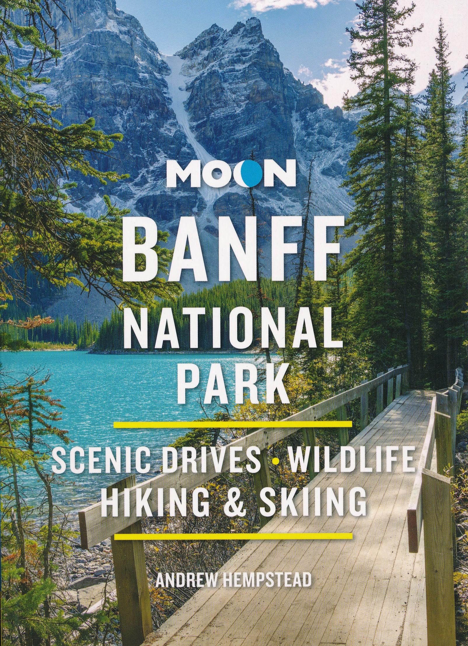
- Moon Banff National Park (Fourth Edition)
- Scenic Drives, Wildlife, Hiking & Skiing Read more
- Also available from:
- De Zwerver, Netherlands
De Zwerver
Netherlands
2022
Netherlands
2022
- Reisgids Banff National Park | Moon Travel Guides
- Scenic Drives, Wildlife, Hiking & Skiing Read more

Stanfords
United Kingdom
United Kingdom
- Banff, Macduff & Turriff - Fyvie OS Explorer Active Map 426 (waterproof)
- Banff, Macduff, Turriff and Fyvie area on a detailed topographic and GPS compatible map No. 426, waterproof version, from the Ordnance Survey’s 1:25,000 Explorer series. MOBILE DOWNLOADS: this title and all the other OS Explorer maps include a code for downloading after purchase the digital version onto your smartphone or tablet for viewing on... Read more
- Also available from:
- The Book Depository, United Kingdom


Stanfords
United Kingdom
United Kingdom
- Banff, Huntly, Portsoy & Turriff OS Landranger Active Map 29 (waterproof)
- Waterproof and tear-resistant OS Active version of map No. 29 from the Ordnance Survey’s Landranger series at 1:50,000, with contoured and GPS compatible topographic mapping plus tourist information.MOBILE DOWNLOADS: As well as the physical edition of the map, each Landranger title now includes a code for downloading after purchase its digital... Read more
- Also available from:
- The Book Depository, United Kingdom

Bol.com
Netherlands
Netherlands
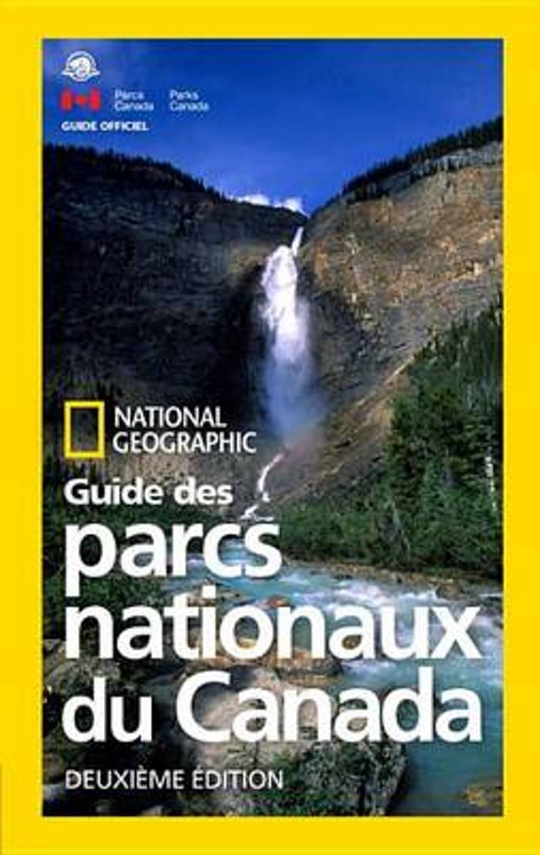
- National Geographic Guide Des Parcs Nationaux Du Canada, Deuxieme Edition
- For avid outdoor fans, Canada's 47 national parks are beautifully showcased in this new French edition of the official guidebook, updated for the country's 150th birthday. This completely updated guidebook shows you how to make the most out of your visit to Canada's 47 gorgeous national parks, just in time for Canada's 150th birthday--from Cape... Read more
- Also available from:
- Bol.com, Belgium
Bol.com
Belgium
Belgium
- National Geographic Guide Des Parcs Nationaux Du Canada, Deuxieme Edition
- For avid outdoor fans, Canada's 47 national parks are beautifully showcased in this new French edition of the official guidebook, updated for the country's 150th birthday. This completely updated guidebook shows you how to make the most out of your visit to Canada's 47 gorgeous national parks, just in time for Canada's 150th birthday--from Cape... Read more
Bol.com
Netherlands
Netherlands
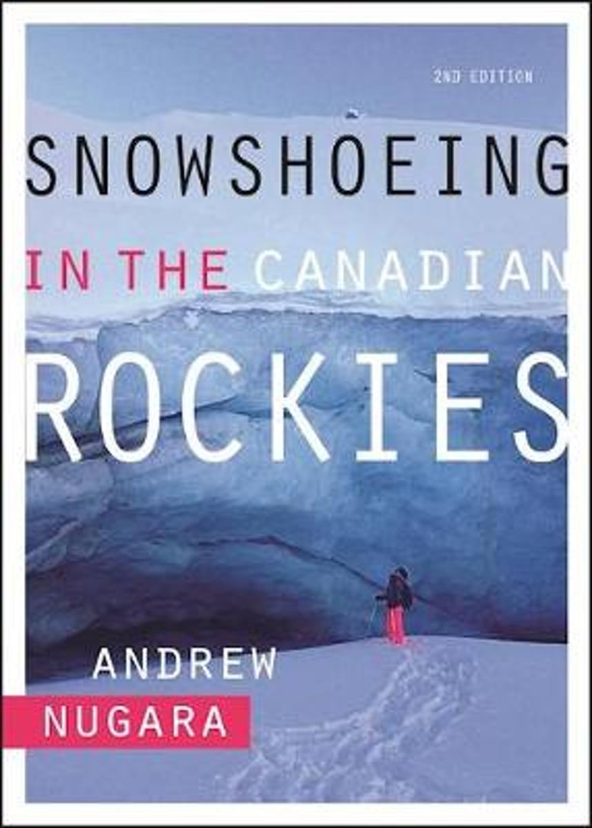
- Snowshoeing in the Canadian Rockies
- This second edition of Snowshoeing in the Canadian Rockies describes 100+ great routes for snowshoers of all levels from beginners who have never snowshoed, to experienced backcountry travelers who are looking for new challenges. The 61 routes described in the first edition have been augmented with 45 new routes, including trips in the... Read more
- Also available from:
- Bol.com, Belgium
Bol.com
Belgium
Belgium
- Snowshoeing in the Canadian Rockies
- This second edition of Snowshoeing in the Canadian Rockies describes 100+ great routes for snowshoers of all levels from beginners who have never snowshoed, to experienced backcountry travelers who are looking for new challenges. The 61 routes described in the first edition have been augmented with 45 new routes, including trips in the... Read more
De Zwerver
Netherlands
Netherlands
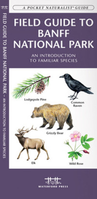
- Vogelgids - Natuurgids Field guide to Banff National Park Wildlife | Waterford Press
- Een bijzonder handige uitklapkaart met alle veelvoorkomende dieren en planten van Banff National Park. Duidelijke illustraties, goede korte omschrijving van soort en leefgebied, geplastificeerd. This fold-up, laminated card features 133 color drawings and short descriptions of commonly encountered wildlife and a map. Laminated for durability,... Read more
Bol.com
Netherlands
2014
Netherlands
2014
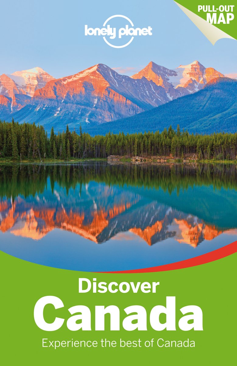
- Lonely Planet Discover Canada
- Lonely Planet's Discover Canada is your passport to the most relevant, up-to-date advice on what to see and skip, and what hidden discoveries await you. Hit the ski slopes at Whistler, wander Quebec's stunning Old Town, marvel at Niagara Falls, hike in Banff National Park; all with your trusted travel companion. Discover the best of Canada and... Read more
- Also available from:
- Bol.com, Belgium
Bol.com
Belgium
2014
Belgium
2014
- Lonely Planet Discover Canada
- Lonely Planet's Discover Canada is your passport to the most relevant, up-to-date advice on what to see and skip, and what hidden discoveries await you. Hit the ski slopes at Whistler, wander Quebec's stunning Old Town, marvel at Niagara Falls, hike in Banff National Park; all with your trusted travel companion. Discover the best of Canada and... Read more
Bol.com
Netherlands
Netherlands
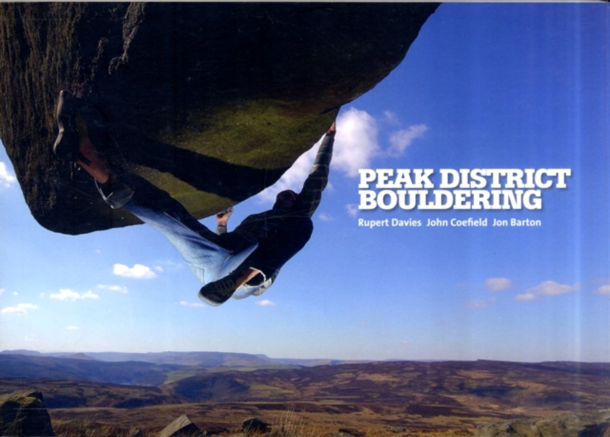
- Peak District Bouldering
- This is the most comprehensive guide to bouldering in the Peak District ever published. All approach, crag and problem information has been reviewed and revised since Vertebrate's first Peak District Bouldering guidebook (2005), and the authors have spent several years researching, writing and updating all of the established crags in the area,... Read more
- Also available from:
- Bol.com, Belgium
Bol.com
Belgium
Belgium
- Peak District Bouldering
- This is the most comprehensive guide to bouldering in the Peak District ever published. All approach, crag and problem information has been reviewed and revised since Vertebrate's first Peak District Bouldering guidebook (2005), and the authors have spent several years researching, writing and updating all of the established crags in the area,... Read more
Maps

Stanfords
United Kingdom
United Kingdom
- British Columbia FastTrack
- British Columbia, with coverage extending to Calgary to include the Banff and Jasper National Parks, on an indexed, waterproof and tear-resistant, handy size FastTrack map, presenting the whole province on two overlapping panels at 1:2,000,000, with more detailed enlargements and street plans covering the Vancouver at 1:1,275,000, the Victoria... Read more

Stanfords
United Kingdom
United Kingdom
- Alberta Pocket Road Atlas
- Pocket road atlas of Alberta presenting the whole province at 1:1,325,000, with numerous enlargement showing in more detail most visited areas, including Banff, Jasper, Canmore, Calgary, Edmonton, etc. The index includes a listing of the province’s national and provincial parks.Road network indicates loose surface and unimproved roads, showing... Read more

Stanfords
United Kingdom
United Kingdom
- Calgary & Southern Alberta Street Atlas
- Street atlas of Calgary and Southern Alberta, Aidrie, Banff, Beiseker, Black Diamond, Bragg Creek, Brooks, Canmore, Chestermere, Coaldale, Cochrane, Crowsnest Pass, Crossfield, Drumheller, High River, Innisfail, Irricana, Lake Louise, Medicin Hat, Okotoks, Olds, Red Deer, Redwood Meadows, Strathmore, Taber and Turner Valley. The atlas is part... Read more

Stanfords
United Kingdom
United Kingdom
- British Columbia - Alberta MapArt
- British Columbia and Alberta, including the Banff and Jasper National Parks, on an indexed, double-sided road map presenting both provinces together at 1:2,000,000, plus more detailed mapping of the region’s main urban areas including Vancouver, Victoria, Calgary, etc.On one side both provinces are shown together at 1:2m with their road network... Read more

Stanfords
United Kingdom
United Kingdom
- Alberta & Saskatchewan
- Alberta, including the Banff and Jasper National Parks, and Saskatchewan on an indexed road map presenting both provinces at 1:1,850,000, each accompanied by several street maps of their main cities, including detailed plans of downtown Calgary, Edmonton, Regina and Saskatoon.On one side is a road map of Alberta with coverage extending within... Read more

Stanfords
United Kingdom
United Kingdom
- Banff - Egypt Lake Gem Trek
- Banff - Egypt Lake, a contoured and GPS compatible map at 1:50,000 from Gem Trek of the main hiking area in the Banff National Park, with coverage around Banff itself, including trails eastwards to Lake Minnewanka and Johnson, and extending westwards across the state border to include parts of Kootenay NP and Mt. Assiniboine Provincial Park.... Read more

Stanfords
United Kingdom
United Kingdom
- Alberta MapArt
- Alberta, including the Banff and Jasper National Parks, on an indexed road map at 1:1,500,000 accompanied by several street maps of its main cities, including plans of Calgary, Edmonton and the holiday resorts of Banff, Jasper and Canmore.The road map shows Alberta at 1:1,500,000 prominently highlighting its numerous national and provincial... Read more

Stanfords
United Kingdom
United Kingdom
- Kootenay Rockies - Calgary and Northern Montana Back Road Atlas
- South-eastern British Columbia with the adjoining regions of Alberta including the Banff and Jasper NP plus the border area of Montana with the Glacier NP presented at 1:250,000 in an A4 paperback road atlas with additional street plans, a listing of local events, etc.Mapping at 1:250,000 covers the areas indicated on our coverage image.... Read more

Stanfords
United Kingdom
United Kingdom
- British Columbia - Alberta FastTrack
- British Columbia and Alberta, including the Banff and Jasper National Parks, on an indexed, double-sided road map presenting both provinces together at 1:2,000,000, plus more detailed mapping of the region’s main urban areas including Vancouver, Victoria, Calgary, etc.On one side both provinces are shown together at 1:2m with their road network... Read more

Stanfords
United Kingdom
United Kingdom
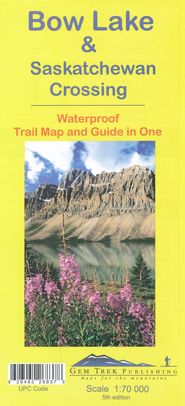
- Bow Lake & Saskatchewan Crossing Gem Trek Map
- Bow Lake - Saskatchewan Crossing region of the Canadian Rockies on a contoured and GPS compatible map at 1:70,000 from Gem Trek with an extension at 1:100,000 to include the Mosquito Creek – Fish Lakes area, plus extensive tourist information on recommended hikes, etc.The map shows trails departing from the southern section of the Icefields... Read more
- Also available from:
- De Zwerver, Netherlands
De Zwerver
Netherlands
Netherlands
- Wandelkaart 03 Bow Lake and Saskatchewan Crossing | Gem Trek Maps
- Bow Lake - Saskatchewan Crossing region of the Canadian Rockies on a contoured and GPS compatible map at 1:70,000 from Gem Trek with an extension at 1:100,000 to include the Mosquito Creek – Fish Lakes area, plus extensive tourist information on recommended hikes, etc.The map shows trails departing from the southern section of the Icefields... Read more

Stanfords
United Kingdom
United Kingdom
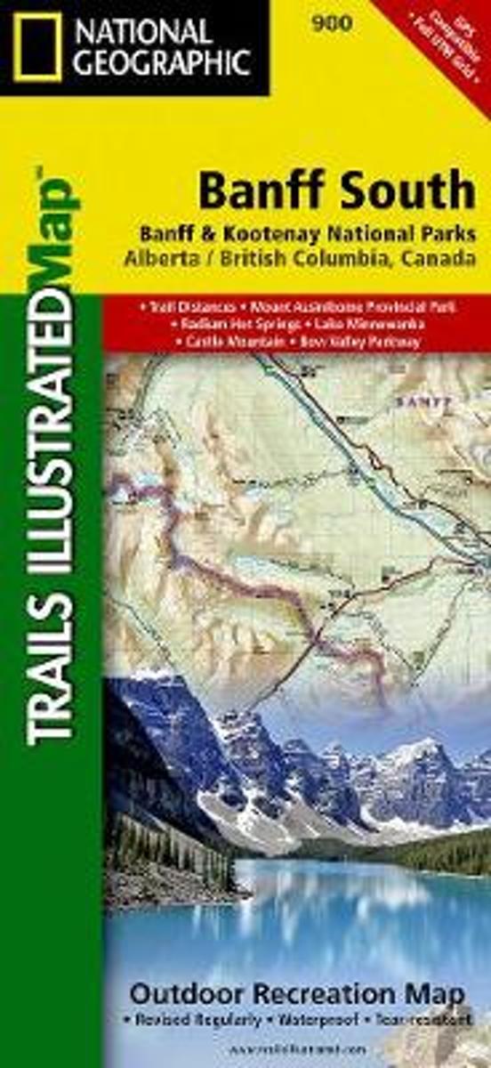
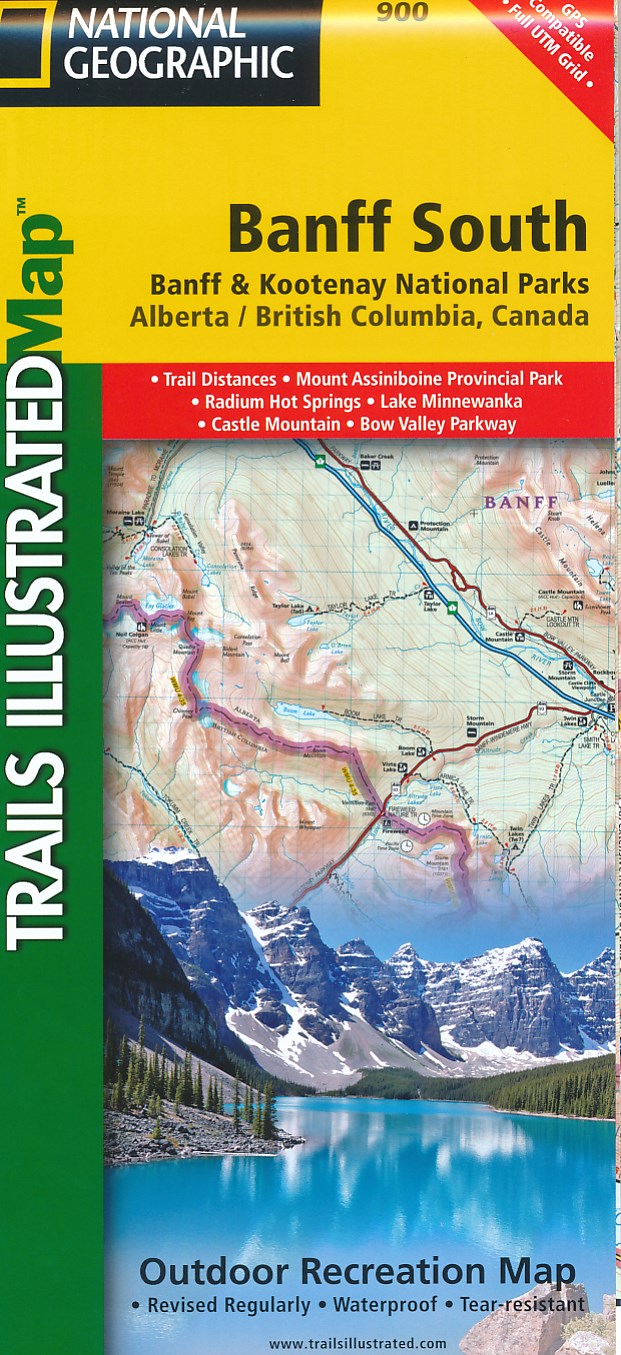
- Banff South - Banff & Kootenay National Parks
- The southern part of the Banff National Park on a double-sided, contoured, GPS compatible recreational map at 1:100,000 from the National Geographic printed on light, waterproof and tear-resistant synthetic paper. Coverage extends to the southern boundary of the Kootenay National Park, with a wide overlap and Banff village shown on both sides... Read more
- Also available from:
- Bol.com, Netherlands
- Bol.com, Belgium
- De Zwerver, Netherlands
Bol.com
Netherlands
Netherlands
- Banff South
- Waterproof Tear-Resistant Topographic MapNational Geographic's Trails Illustrated map of Banff South is a two-sided, waterproof map designed to meet the needs of outdoor enthusiasts with unmatched durability and detail. This map was created in conjunction with local land management agencies and is loaded with valuable recreation... Read more
Bol.com
Belgium
Belgium
- Banff South
- Waterproof Tear-Resistant Topographic MapNational Geographic's Trails Illustrated map of Banff South is a two-sided, waterproof map designed to meet the needs of outdoor enthusiasts with unmatched durability and detail. This map was created in conjunction with local land management agencies and is loaded with valuable recreation... Read more
De Zwerver
Netherlands
Netherlands
- Wandelkaart 900 Banff South National Park | National Geographic
- The southern part of the Banff National Park on a double-sided, contoured, GPS compatible recreational map at 1:100,000 from the National Geographic printed on light, waterproof and tear-resistant synthetic paper. Coverage extends to the southern boundary of the Kootenay National Park, with a wide overlap and Banff village shown on both sides... Read more

Stanfords
United Kingdom
United Kingdom
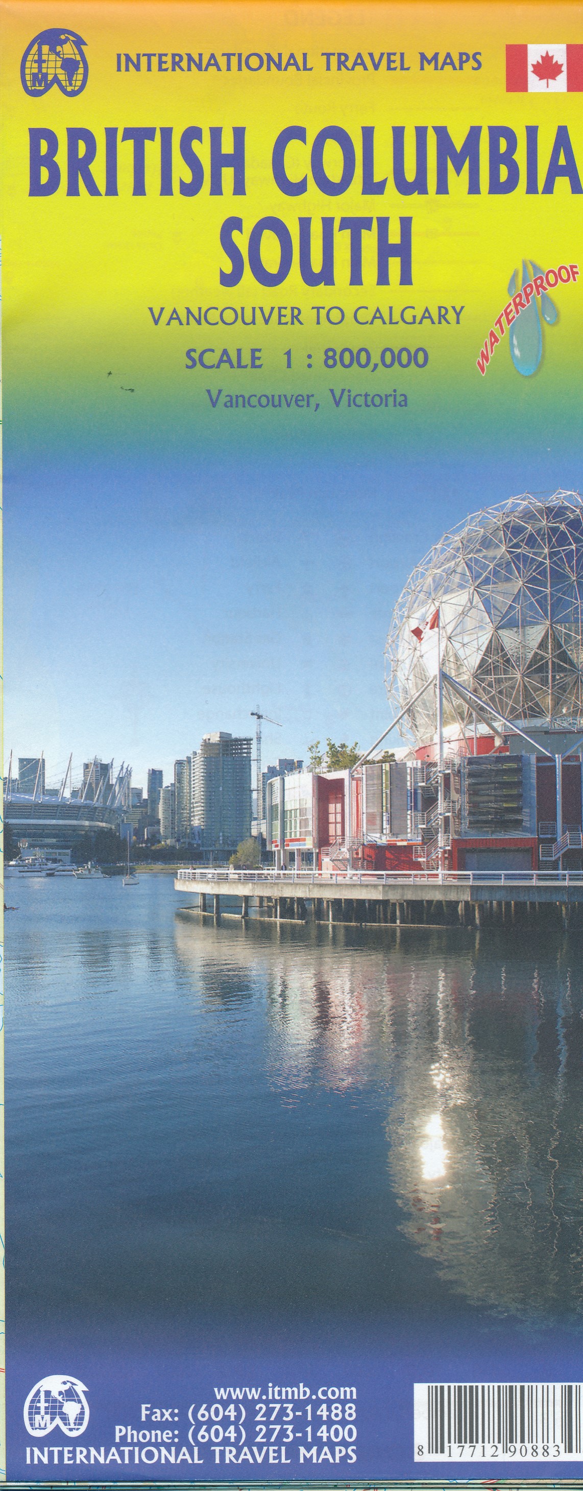
- British Columbia South ITMB
- Indexed double-sided road map at 1:800,000 from ITMB of the southern part of British Columbia, extending from Vancouver Island to Calgary to cover the whole of the Banff and Jasper National Parks, with plans of downtown Vancouver and Victoria. Coverage northwards extends to include the southern part of Haida Gwai (Queen Charlotte) Islands and... Read more
- Also available from:
- De Zwerver, Netherlands
De Zwerver
Netherlands
Netherlands
- Wegenkaart - landkaart British Columbia South (Canada) | ITMB
- Indexed double-sided road map at 1:900,000 from ITMB of the southern part of British Columbia, extending from Vancouver Island to Calgary to cover the whole of the Banff and Jasper National Parks, with plans of downtown Vancouver and Victoria. Coverage northwards extends to include the southern part of Haida Gwai (Queen Charlotte) Islands and... Read more

Stanfords
United Kingdom
United Kingdom
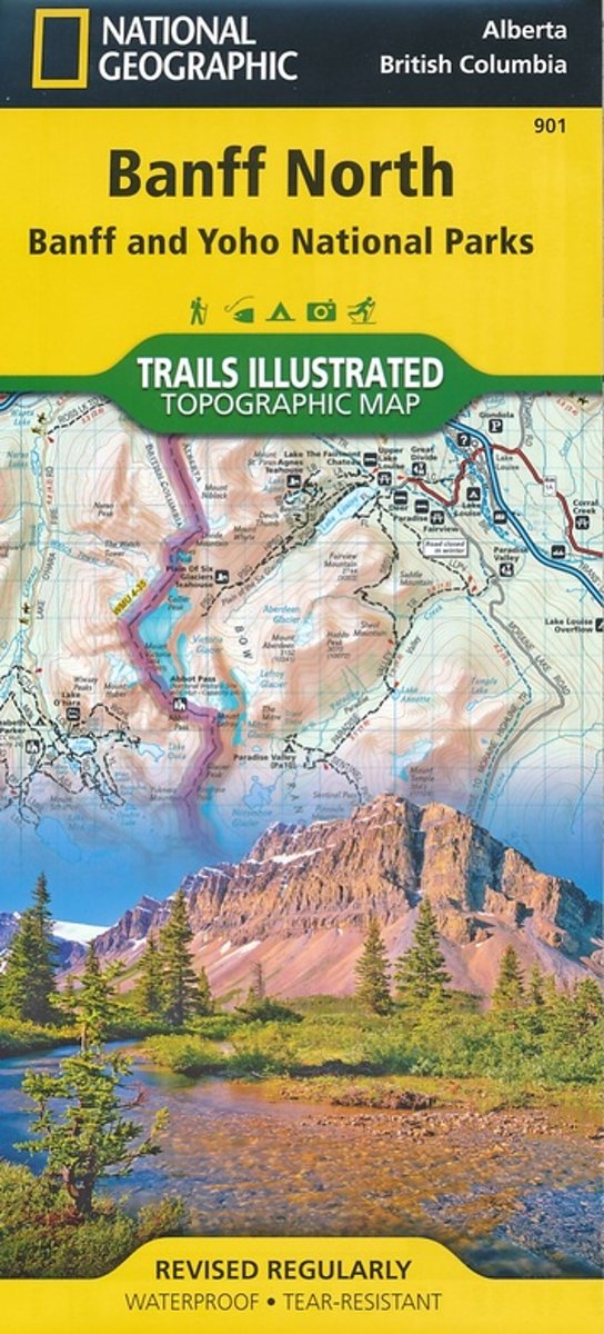
- Banff North - Banff and Yoho National Parks NGS Trails Illustrated Map 901
- The northern part of the Banff National Park on a double-sided, contoured, GPS compatible recreational map at 1:100,000 from the National Geographic printed on light, waterproof and tear-resistant synthetic paper. Coverage includes Lake Louise, the Saskatchewan River Crossing and the Columbia Icefield.This title is part of a series of four... Read more
- Also available from:
- Bol.com, Netherlands
- Bol.com, Belgium
- De Zwerver, Netherlands
Bol.com
Netherlands
Netherlands
- Banff North
- Waterproof Tear-Resistant Topographic MapNational Geographic's Trails Illustrated map of Banff North is a two-sided, waterproof map designed to meet the needs of outdoor enthusiasts with unmatched durability and detail. This map was created in conjunction with local land management agencies and is loaded with valuable recreation... Read more
Bol.com
Belgium
Belgium
- Banff North
- Waterproof Tear-Resistant Topographic MapNational Geographic's Trails Illustrated map of Banff North is a two-sided, waterproof map designed to meet the needs of outdoor enthusiasts with unmatched durability and detail. This map was created in conjunction with local land management agencies and is loaded with valuable recreation... Read more

De Zwerver
Netherlands
Netherlands
- Wandelkaart 901 Banff North National Park | National Geographic
- The northern part of the Banff National Park on a double-sided, contoured, GPS compatible recreational map at 1:100,000 from the National Geographic printed on light, waterproof and tear-resistant synthetic paper. Coverage includes Lake Louise, the Saskatchewan River Crossing and the Columbia Icefield.This title is part of a series of four... Read more
De Zwerver
Netherlands
Netherlands