
Noord-Holland
Description
Map

Trails in this state
- Duin- en PolderpadGPX
- Duinweg Rondwandeling
- E9GPX
- Floris V-padGPX
- GR12 - Amsterdam - ParisGPX
- Groot-FrieslandpadGPX
- Hollands KustpadGPX
- Jacobsweg Amstelredam
- Jacobsweg Die Haghe
- Nederlands KustpadGPX
- Noord-HollandpadGPX
- North Sea TrailGPX
- Omringdijk WandelrouteGPX
- Omringdijkpad
- PelgrimspadGPX
- Stelling van AmsterdamGPX
- TexelpadGPX
- TrekvogelpadGPX
- Van Wad tot IJ
- WaterliniepadGPX
- WesterborkpadGPX
- Willebrordus Wandelpad
- ZuiderzeepadGPX
Links
Facts
Reports
Guides and maps
Lodging
Organisations
Tour operators
GPS
Other
Books

Stanfords
United Kingdom
United Kingdom
- Eastbourne, Hastings, Crowborough, Battle & Heathfield OS Landranger Active Map 199 (waterproof)
- Eastbourne and Hastings area, including the Seven Sisters and sections of the South Downs Way and the E9 European Long-distance Path, on a waterproof and tear-resistant OS Active version of map No. 199 from the Ordnance Survey’s Landranger series at 1:50,000, with contoured and GPS compatible topographic mapping plus tourist information.MOBILE... Read more

Stanfords
United Kingdom
United Kingdom
- Bournemouth, Purbeck, Wimborne Minster & Ringwood OS Landranger Active Map 195 (waterproof)
- Bournemouth and the Isle of Purbeck area, including part of the New Forest National Park and a section of the South West Coast Path / E9 European Long-distance Path, on a waterproof and tear-resistant OS Active version of map No. 195 from the Ordnance Survey’s Landranger series at 1:50,000, with contoured and GPS compatible topographic mapping... Read more

Stanfords
United Kingdom
United Kingdom
- The Solent, Isle of Wight, Southampton & Portsmouth OS Landranger Active Map 196 (waterproof)
- Isle of Wight with the Southampton - Portsmouth area, including part of the New Forest National Park and a section of the E9 European Long-distance Path, on a waterproof and tear-resistant OS Active version of map No. 196 from the Ordnance Survey’s Landranger series at 1:50,000, with contoured and GPS compatible topographic mapping plus tourist... Read more

Stanfords
United Kingdom
United Kingdom
- Taunton, Lyme Regis, Chard & Bridport OS Landranger Active Map 193 (waterproof)
- Taunton and Lyme Regis area, including a section of the South West Coast Path / E9 European Long-distance Path, on a waterproof and tear-resistant OS Active version of map No. 193 from the Ordnance Survey’s Landranger series at 1:50,000, with contoured and GPS compatible topographic mapping plus tourist information.MOBILE DOWNLOADS: As well as... Read more
- Also available from:
- The Book Depository, United Kingdom


Stanfords
United Kingdom
United Kingdom
- Eastbourne, Hastings, Crowborough, Battle & Heathfield OS Landranger Map 199 (paper)
- Eastbourne and Hastings area, including the Seven Sisters and sections of the South Downs Way and the E9 European Long-distance Path, on a paper version of map No. 199 from the Ordnance Survey’s Landranger series at 1:50,000, with contoured and GPS compatible topographic mapping plus tourist information.MOBILE DOWNLOADS: As well as the physical... Read more
- Also available from:
- The Book Depository, United Kingdom
- De Zwerver, Netherlands


De Zwerver
Netherlands
Netherlands

Stanfords
United Kingdom
United Kingdom
- Canterbury, East Kent, Dover & Margate OS Landranger Active Map 179 (waterproof)
- Eastern Kent with Canterbury, Dover and Margate, including sections of the North Downs Way and the E2 and E9 European Long-Distance Paths, on a waterproof and tear-resistant OS Active version of map No. 179 from the Ordnance Survey’s Landranger series at 1:50,000, with contoured and GPS compatible topographic mapping plus tourist... Read more
- Also available from:
- The Book Depository, United Kingdom


Stanfords
United Kingdom
United Kingdom
- Purbeck & South Dorset - Poole, Dorchester - Weymouth & Swanage OS Explorer Active Map OL15 (waterproof)
- Purbeck and the southern part of Dorset on a detailed topographic and GPS compatible map OL15, waterproof version, from the Ordnance Survey’s 1:25,000 Explorer series. Coverage extends from Poole and Swanage in the east to Bridport in the west, and includes Dorchester, Tolpuddle, Bere Regis, Wareham, Weymouth, Chesil Beach, Portland Bill, the... Read more
- Also available from:
- The Book Depository, United Kingdom

The Book Depository
United Kingdom
United Kingdom

Stanfords
United Kingdom
United Kingdom
- Ashford, Romney Marsh, Rye & Folkestone OS Landranger Map 189 (paper)
- Ashford and Romney Marsh area, including sections of the North Downs Way and the E9 European Long-distance Path, on a paper version of map No. 189 from the Ordnance Survey’s Landranger series at 1:50,000, with contoured and GPS compatible topographic mapping plus tourist information.MOBILE DOWNLOADS: As well as the physical edition of the map,... Read more
- Also available from:
- The Book Depository, United Kingdom
- De Zwerver, Netherlands


De Zwerver
Netherlands
Netherlands

Stanfords
United Kingdom
United Kingdom
- Dorchester, Weymouth, Cerne Abbas & Bere Regis OS Landranger Map 194 (paper)
- Dorchester and Weymouth area, including a section of the South West Coast Path / E9 European Long-distance Path, on a paper version of map No. 194 from the Ordnance Survey’s Landranger series at 1:50,000, with contoured and GPS compatible topographic mapping plus tourist information.MOBILE DOWNLOADS: As well as the physical edition of the map,... Read more
- Also available from:
- The Book Depository, United Kingdom
- De Zwerver, Netherlands


De Zwerver
Netherlands
Netherlands

Stanfords
United Kingdom
United Kingdom
- Exeter, Sidmouth, Exmouth & Teignmouth OS Landranger Map 192 (paper)
- Exeter and Sidmouth area, including a section of the South West Coast Path / E9 European Long-distance Path, on a paper version of map No. 192 from the Ordnance Survey’s Landranger series at 1:50,000, with contoured and GPS compatible topographic mapping plus tourist information.MOBILE DOWNLOADS: As well as the physical edition of the map, each... Read more
- Also available from:
- The Book Depository, United Kingdom
- De Zwerver, Netherlands


De Zwerver
Netherlands
Netherlands

Stanfords
United Kingdom
United Kingdom
- Ashford, Romney Marsh, Rye & Folkestone OS Landranger Active Map 189 (waterproof)
- Ashford and Romney Marsh area, including sections of the North Downs Way and the E9 European Long-distance Path, on a waterproof and tear-resistant OS Active version of map No. 189 from the Ordnance Survey’s Landranger series at 1:50,000, with contoured and GPS compatible topographic mapping plus tourist information.MOBILE DOWNLOADS: As well as... Read more
- Also available from:
- The Book Depository, United Kingdom


Stanfords
United Kingdom
United Kingdom
- The Solent, Isle of Wight, Southampton & Portsmouth OS Landranger Map 196 (paper)
- Isle of Wight with the Southampton - Portsmouth area, including part of the New Forest National Park and a section of the E9 European Long-distance Path, on a paper version of map No. 196 from the Ordnance Survey’s Landranger series at 1:50,000, with contoured and GPS compatible topographic mapping plus tourist information.MOBILE DOWNLOADS: As... Read more
- Also available from:
- The Book Depository, United Kingdom
- De Zwerver, Netherlands


De Zwerver
Netherlands
Netherlands

Stanfords
United Kingdom
United Kingdom
- Taunton, Lyme Regis, Chard & Bridport OS Landranger Map 193 (paper)
- Taunton and Lyme Regis area, including a section of the South West Coast Path / E9 European Long-distance Path, on a paper version of map No. 193 from the Ordnance Survey’s Landranger series at 1:50,000, with contoured and GPS compatible topographic mapping plus tourist information.MOBILE DOWNLOADS: As well as the physical edition of the map,... Read more
- Also available from:
- The Book Depository, United Kingdom
- De Zwerver, Netherlands


De Zwerver
Netherlands
Netherlands

Stanfords
United Kingdom
United Kingdom
- Exeter, Sidmouth, Exmouth & Teignmouth OS Landranger Active Map 192 (waterproof)
- Exeter and Sidmouth area, including a section of the South West Coast Path / E9 European Long-distance Path, on a waterproof and tear-resistant OS Active version of map No. 192 from the Ordnance Survey’s Landranger series at 1:50,000, with contoured and GPS compatible topographic mapping plus tourist information.MOBILE DOWNLOADS: As well as the... Read more
- Also available from:
- The Book Depository, United Kingdom


Stanfords
United Kingdom
United Kingdom
- Chichester, South Downs, Bognor Regis & Arundel OS Landranger Map 197 (paper)
- Chichester and Bognor Regis area, including the South Downs National Park and a section of the South Downs Way / E9 European Long-distance Path, on a paper version of map No. 197 from the Ordnance Survey’s Landranger series at 1:50,000, with contoured and GPS compatible topographic mapping plus tourist information.MOBILE DOWNLOADS: As well as... Read more
- Also available from:
- The Book Depository, United Kingdom
- De Zwerver, Netherlands


De Zwerver
Netherlands
Netherlands
Maps

Stanfords
United Kingdom
2012
United Kingdom
2012
- Amsterdam Waterland
- Amsterdam Waterland on a waterproof, tear-resistant, GPS compatible walking map at 1:25,000 from Trage Paden, in a series of maps with extensive overprint for long-distance and local walking routes. GPS waypoints and route profiles are available for download from the publisher’s website.Contours used in this map series vary between 2,5 to 5m... Read more

Stanfords
United Kingdom
2012
United Kingdom
2012
- Amsterdam Amstelland
- Amsterdam Amstelland on a waterproof, tear-resistant, GPS compatible walking map at 1:25,000 from Trage Paden, in a series of maps with extensive overprint for long-distance and local walking routes. GPS waypoints and route profiles are available for download from the publisher’s website.Contours used in this map series vary between 2,5 to 5m... Read more

Stanfords
United Kingdom
United Kingdom
- North Holland - with Kennemerland Falkplan Cycling Map 13
- North Holland Province of the Netherlands at 1:50,000 in a series from Falk B.V. showing the network of signposted cycling routes on large, double-sided indexed maps with prominent highlighting of long-distance LF routes, symbols indicating accommodation and other tourist services, plus in each title two or more panels with recommended local... Read more

De Zwerver
Netherlands
Netherlands
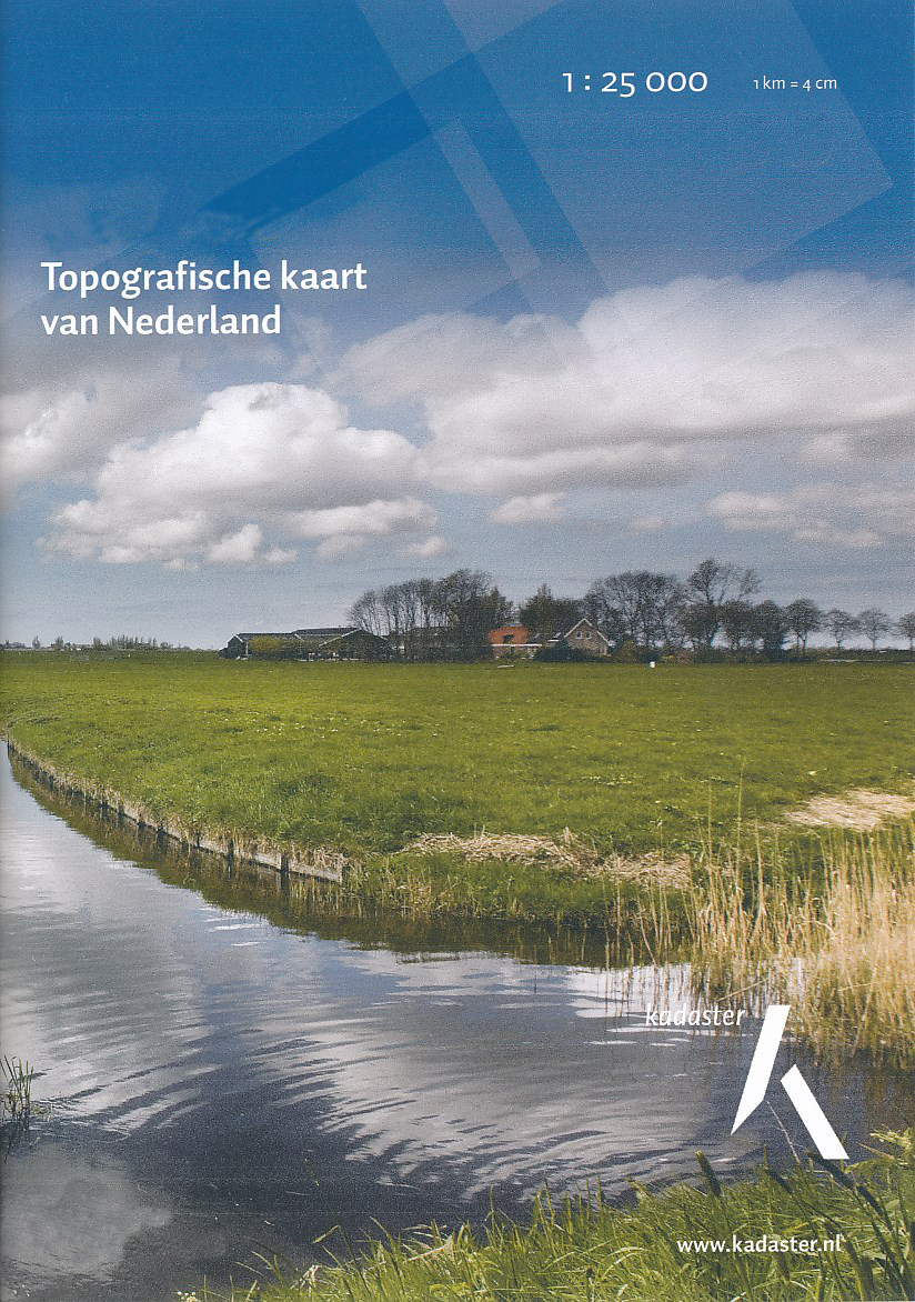
- Topografische kaart - Wandelkaart 19F Hoorn | Kadaster
- De meest gedetailleerde kaart die via de verkoopkanalen verkrijgbaar is. Gemaakt door de Nederlandse Topografische dienst bevat deze kaart alle topografische elementen van het landschap en geeft daarmee een nauwkeurig beeld van het terrein. De meeste kaarten hebben een kaartbeeld dat overeenkomt met 12,5 x 10 kilometer in werkelijkheid. Naast... Read more

De Zwerver
Netherlands
Netherlands
- Topografische kaart - Wandelkaart 14A Callantsoog | Kadaster
- De meest gedetailleerde kaart die via de verkoopkanalen verkrijgbaar is. Gemaakt door de Nederlandse Topografische dienst bevat deze kaart alle topografische elementen van het landschap en geeft daarmee een nauwkeurig beeld van het terrein. De meeste kaarten hebben een kaartbeeld dat overeenkomt met 12,5 x 10 kilometer in werkelijkheid. Naast... Read more
De Zwerver
Netherlands
Netherlands

De Zwerver
Netherlands
Netherlands
- Topografische kaart - Wandelkaart 25C Hoofddorp | Kadaster
- De meest gedetailleerde kaart die via de verkoopkanalen verkrijgbaar is. Gemaakt door de Nederlandse Topografische dienst bevat deze kaart alle topografische elementen van het landschap en geeft daarmee een nauwkeurig beeld van het terrein. De meeste kaarten hebben een kaartbeeld dat overeenkomt met 12,5 x 10 kilometer in werkelijkheid. Naast... Read more

De Zwerver
Netherlands
Netherlands
- Topografische kaart - Wandelkaart 14D Schagen | Kadaster
- De meest gedetailleerde kaart die via de verkoopkanalen verkrijgbaar is. Gemaakt door de Nederlandse Topografische dienst bevat deze kaart alle topografische elementen van het landschap en geeft daarmee een nauwkeurig beeld van het terrein. De meeste kaarten hebben een kaartbeeld dat overeenkomt met 12,5 x 10 kilometer in werkelijkheid. Naast... Read more

De Zwerver
Netherlands
Netherlands
- Topografische kaart - Wandelkaart 19G Purmerend | Kadaster
- De meest gedetailleerde kaart die via de verkoopkanalen verkrijgbaar is. Gemaakt door de Nederlandse Topografische dienst bevat deze kaart alle topografische elementen van het landschap en geeft daarmee een nauwkeurig beeld van het terrein. De meeste kaarten hebben een kaartbeeld dat overeenkomt met 12,5 x 10 kilometer in werkelijkheid. Naast... Read more

De Zwerver
Netherlands
Netherlands
- Topografische kaart - Wandelkaart 9D Den Helder | Kadaster
- De meest gedetailleerde kaart die via de verkoopkanalen verkrijgbaar is. Gemaakt door de Nederlandse Topografische dienst bevat deze kaart alle topografische elementen van het landschap en geeft daarmee een nauwkeurig beeld van het terrein. De meeste kaarten hebben een kaartbeeld dat overeenkomt met 12,5 x 10 kilometer in werkelijkheid. Naast... Read more

De Zwerver
Netherlands
Netherlands
- Topografische kaart - Wandelkaart 25D Amstelveen | Kadaster
- De meest gedetailleerde kaart die via de verkoopkanalen verkrijgbaar is. Gemaakt door de Nederlandse Topografische dienst bevat deze kaart alle topografische elementen van het landschap en geeft daarmee een nauwkeurig beeld van het terrein. De meeste kaarten hebben een kaartbeeld dat overeenkomt met 12,5 x 10 kilometer in werkelijkheid. Naast... Read more
De Zwerver
Netherlands
Netherlands
- Topografische kaart - Wandelkaart 14E Hippolyteshoef | Kadaster
- De meest gedetailleerde kaart die via de verkoopkanalen verkrijgbaar is. Gemaakt door de Nederlandse Topografische dienst bevat deze kaart alle topografische elementen van het landschap en geeft daarmee een nauwkeurig beeld van het terrein. De meeste kaarten hebben een kaartbeeld dat overeenkomt met 12,5 x 10 kilometer in werkelijkheid. Naast... Read more