
Wetterstein
Description

The busy Wettersteingebirge on the border of Germany and Austria is home to Germany's highest mountain, the Zugspitze (2962 m). Those who choose one of the two beautiful Klettersteige to reach the top, will arrive in an enormous crowd, because the summit is crowned by a "hut" (say entertainment center) which can be comfortably reached by cable car, dragging up and down hundreds (if not thousands) of tourists every day. Nonetheless, the views are beautiful.
In Germany, one speaks of the Werdenfels region, with Garmisch-Partenkirchen in its center. The area includes parts of the Ammergauer Alps and Estergebirge.
Wetterstein is sandwiched between two popular Austrian-German mountain passes: the Fernpass in the west and the Scharnitz Pass to the east. These passes are well known to holidaymakers. The area in between is interesting for climbers among us. The limestone (Wetterstein is part of the Northern Limestone Alps) here is particularly harsh: Wettersteinkalk. Walking is possible too, well catered for by the many huts, but you should have a good condition. You can make things easier by making use of the frequent cable cars. There are also quit a few Klettersteige (secured climbs) throughout the area, so you can move safely through the attractive rock scenery.
Map


Trails in this region
Links
Facts
Reports
Guides and maps
Lodging
Organisations
Tour operators
GPS
Other
Books

United Kingdom
2018
- Walking in the Bavarian Alps
- A comprehensive guidebook detailing walks in Germany`s Bavarian Alps. Lying along the German-Austrian border in a thin sliver of land roughly 300km long, this area contains some of the most spectacular walking and beautiful scenery that Germany has to offer. 70 graded walks explore mountain landscapes, wild mountain gorges and alpine meadows as... Read more
- Also available from:
- The Book Depository, United Kingdom
- De Zwerver, Netherlands

United Kingdom
2018
- Walking in the Bavarian Alps
- 70 mountain walks and treks in southern Germany Read more

Netherlands
2018
- Wandelgids Beieren - Walking in the Bavarian Alps | Cicerone
- Guidebook to mountain walks and treks in the Bavarian Alps, on the border of Germany and Austria, between Lake Constance and Berchtesgaden. Accessible from Munich, Salzburg and Innsbruck, these 70 routes range from half-day walks to 3-day hut-to-hut treks. Highlights include the Königssee and Breitach, Partnach and Höllental gorges. Read more


United Kingdom
2017
- The Swiss Alpine Pass Route - via Alpina Route 1: Trekking East to West Across Switzerland
- This guidebook presents the stunning Alpine Pass Route, now fully waymarked as Via Alpina 1. The 360km trail traverses Switzerland from east to west, from Sargans near the Liechtenstein border to Montreux on Lac Leman (Lake Geneva). Crossing sixteen Alpine passes, it showcases some of the country`s most breathtaking mountain landscapes,... Read more
- Also available from:
- Bol.com, Netherlands
- Bol.com, Belgium

Netherlands
2017
- The Swiss alpine pass route - Via Alpina route 1
- This guidebook presents the stunning Alpine Pass Route, now fully waymarked as Via Alpina 1. The 360km trail traverses Switzerland from east to west, from Sargans near the Liechtenstein border to Montreux on Lac Léman (Lake Geneva). Crossing sixteen Alpine passes, it showcases some of the country's most breathtaking mountain landscapes,... Read more
Belgium
2017
- The Swiss alpine pass route - Via Alpina route 1
- This guidebook presents the stunning Alpine Pass Route, now fully waymarked as Via Alpina 1. The 360km trail traverses Switzerland from east to west, from Sargans near the Liechtenstein border to Montreux on Lac Léman (Lake Geneva). Crossing sixteen Alpine passes, it showcases some of the country's most breathtaking mountain landscapes,... Read more

Netherlands
- Un Jubilado En Los Alpes
- Se aproximaba el verano y era necesario decidirse. Entre unos pocos proyectos previstos hasta esos dias, que habian ido surgiendo en mi imaginacion durante el invierno, se fueron concretando a mitad de la primavera la posibilidad de caminar por el Himalaya, en Cachemira, recorrer algunos valles del Caucaso al norte de Georgia o atravesar los... Read more
- Also available from:
- Bol.com, Belgium
Belgium
- Un Jubilado En Los Alpes
- Se aproximaba el verano y era necesario decidirse. Entre unos pocos proyectos previstos hasta esos dias, que habian ido surgiendo en mi imaginacion durante el invierno, se fueron concretando a mitad de la primavera la posibilidad de caminar por el Himalaya, en Cachemira, recorrer algunos valles del Caucaso al norte de Georgia o atravesar los... Read more
Netherlands
- Bayerns Berge
- Warum in die Ferne schweifen und eine weite Anreise in die Zentralalpen in Kauf nehmen, wenn das Gute so nahe liegt? Der bayerische Alpenbogen zwischen Allgäu und Berchtesgaden - die Allgäuer Alpen, die Ammergauer Alpen, das Wettersteingebirge, die Bayerischen Voralpen mit Estergebirge, Walchenseebergen, Benediktenwandgruppe und... Read more
- Also available from:
- Bol.com, Belgium
Belgium
- Bayerns Berge
- Warum in die Ferne schweifen und eine weite Anreise in die Zentralalpen in Kauf nehmen, wenn das Gute so nahe liegt? Der bayerische Alpenbogen zwischen Allgäu und Berchtesgaden - die Allgäuer Alpen, die Ammergauer Alpen, das Wettersteingebirge, die Bayerischen Voralpen mit Estergebirge, Walchenseebergen, Benediktenwandgruppe und... Read more

Netherlands
2022
Netherlands
- WF5955 Zugspitze, von der Zugspitze zum Gardasee Kompass
- Die KOMPASS Wanderführer überzeugen durch . nützliche Tourenübersicht zur schnellen Orientierung . übersichtliche und präzise Wegbeschreibungen . XXL Kartenausschnitte für einen großzügigen Überblick . aussagekräftiges Höhenprofil zur einfachen Planung . persönliche Empfehlungen der AutorenDe Kompass wandelgids + kaart geeft een overzicht van... Read more
- Also available from:
- Bol.com, Belgium
Belgium
- WF5955 Zugspitze, von der Zugspitze zum Gardasee Kompass
- Die KOMPASS Wanderführer überzeugen durch . nützliche Tourenübersicht zur schnellen Orientierung . übersichtliche und präzise Wegbeschreibungen . XXL Kartenausschnitte für einen großzügigen Überblick . aussagekräftiges Höhenprofil zur einfachen Planung . persönliche Empfehlungen der AutorenDe Kompass wandelgids + kaart geeft een overzicht van... Read more

Netherlands
- WF5421 Allgäu, Allgäuer Alpen Kompass
- De Kompass wandelgids + kaart geeft een overzicht van alle wandelroutes in het gebied met nauwkeurige routeaanwijzingen en hoogteaanduidingen, De extra grote kaart, schaal 1:35 000, is ideaal om van te voren uw route uit te stippelen en om onderweg te gebruiken • naast de bekende bestemmingen, worden ook de minder bekende vermeld • openbaar... Read more
- Also available from:
- Bol.com, Belgium
Belgium
- WF5421 Allgäu, Allgäuer Alpen Kompass
- De Kompass wandelgids + kaart geeft een overzicht van alle wandelroutes in het gebied met nauwkeurige routeaanwijzingen en hoogteaanduidingen, De extra grote kaart, schaal 1:35 000, is ideaal om van te voren uw route uit te stippelen en om onderweg te gebruiken • naast de bekende bestemmingen, worden ook de minder bekende vermeld • openbaar... Read more

Netherlands
2022
- Klimgids - Klettersteiggids Bayern, Vorarlberg, Tirol, Salzburg | Rother Bergverlag
- 92 Klettersteige zwischen Rhein und Salzach Rother Wanderführer. 10., vollständig neu bearbeitete Auflage. Read more
Netherlands
- Journey Through Upper Bavaria
- Upper Bavaria is presented as the epitome of all things Bavarian in this travel guide, exploring its magnificent Alpine scenery as well as ancient traditions and festivals where lederhosen and the dirndl are worn with pride. Mountain chalets, their balconies a riot of floral color, are captured in lush green pastures beneath the snow-capped... Read more
- Also available from:
- Bol.com, Belgium
Belgium
- Journey Through Upper Bavaria
- Upper Bavaria is presented as the epitome of all things Bavarian in this travel guide, exploring its magnificent Alpine scenery as well as ancient traditions and festivals where lederhosen and the dirndl are worn with pride. Mountain chalets, their balconies a riot of floral color, are captured in lush green pastures beneath the snow-capped... Read more
Netherlands
- Appalachian Safari
- Join the author David Adam Atwell on his adventures high up in the Blue Ridge Mountains of Appalachia as he hikes, camps, and learns to shoot, fish, and hunt. Laugh at his family's antics and hold your breath in anticipation of success or defeat. Visit a hunting cabin, get lost in the woods, go fishing up Cripple Creek, and learn to make... Read more
- Also available from:
- Bol.com, Belgium
Belgium
- Appalachian Safari
- Join the author David Adam Atwell on his adventures high up in the Blue Ridge Mountains of Appalachia as he hikes, camps, and learns to shoot, fish, and hunt. Laugh at his family's antics and hold your breath in anticipation of success or defeat. Visit a hunting cabin, get lost in the woods, go fishing up Cripple Creek, and learn to make... Read more

Netherlands
2023

- Also available from:
- Bol.com, Belgium

Netherlands
2014
- Walking in the Bavarian Alps
- Guidebook describing a both valley and mountain walks and treks in the Bavarian Alps. 85 walks are covered, including graded mountain routes, gentler valley walks, hut-to-hut routes and two multi-day tours, arranged by region with practical information on transport, accommodation and the like. Since the last edition of this guide many of the... Read more
- Also available from:
- Bol.com, Belgium
Belgium
2014
- Walking in the Bavarian Alps
- Guidebook describing a both valley and mountain walks and treks in the Bavarian Alps. 85 walks are covered, including graded mountain routes, gentler valley walks, hut-to-hut routes and two multi-day tours, arranged by region with practical information on transport, accommodation and the like. Since the last edition of this guide many of the... Read more

Netherlands
2013
- Wandelgids Münchner Wanderberge | Rother Bergverlag
- De ‘Rother Wanderbücher’ behandelen telkens de 50 mooiste wandelingen, die variëren van eenvoudige kindvriendelijke wandelingen tot routes die aanzienlijk meer ervaring vereisen. Uitvoerige routebeschrijvingen, een aantrekkelijke lay-out met vele kleurenfoto’s, niets aan duidelijkheid te wensen gelaten hoogteprofielen, kaartjes met de... Read more
Maps

United Kingdom
- Styrian Winelands - Southwest Styria F&B WK411
- Styrian Winelands area south-eastern Austria presented at 1:50,000 in a series of contoured and GPS compatible outdoor leisure map from Freytag & Berndt with hiking and cycling routes, mountain huts, campsites and youth hostels, local bus stops, plus other tourist information. To see the list of currently available titles in this series please... Read more

United Kingdom
- Goms - Aletsch
- Goms - Aletsch area of the Bernese Oberland at 1:50,000 in a series from Hallwag covering Switzerland’s popular hiking regions on light, waterproof and tear-resistant maps highlighting long-distance paths: the nine national routes plus special regional routes, as well as other local hiking trails.Cartography is similar to that used both in... Read more
United Kingdom
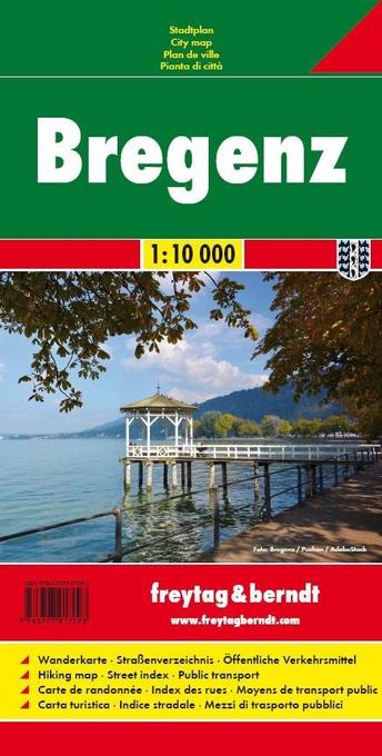
- Bregenz F&B
- Indexed street plan of Bregenz extending north along the Bodensee coast to Lochau and Unter Hochsteg. Detail includes pedestrianised areas, railways, bus routes and cycle paths. Notable buildings are highlighted in red, and symbols indicate post offices, hostels, campsites and car parks.On the reverse is a 1:50,000 contoured map of the... Read more

United Kingdom
- Olympus Geopsis 139
- Mt Olympus in a series of waterproof and tear-resistant hiking maps at scales varying from 1:50,000 to 1:10,000, with a UTM grid for GPS users. Contour interval varies depending on the scale, on most maps it is 20m. Relief shading, spot heights, springs, seasonal streams and, in most titles, landscape/land-use variations, e.g. forests,... Read more

United Kingdom
- Taygetos - North Taygetos Anavasi 8.1
- The Taygetos range between Sparta and Kalamata at 1:50,000 on a contoured, GPS compatible map from Anavasi with on the reverse a special map highlighting the region’s numerous hiking trails, including the course of the E4 European long-distance path.On one side is the main map of the area with excellent presentation of its topography by... Read more

United Kingdom
- Hungarian National Long-distance Blue Trail (E4): Visegrad to Irott-ko
- Hiking guide to the north-western section of Hungary’s National Blue Trail which forms part of the E4 European long-distance footpath. The guide covers the route from the historic town of Visegrád on the Danube, across the Buda Hills on the outskirts of Budapest and the Bakony Hills along the north-eastern shore of Lake Balaton, to Írott-ko in... Read more

United Kingdom
- Greece: Attika and Central Greece Road Atlas
- Road Atlas of Attika, the region around Athens, and Central Greece from Anavasi, in an A4 paperback format, with contoured mapping at 1:50,000, a 2km UTM grid for GPS users, very detailed road classification, hiking paths, and place names in both Greek and Latin alphabets.The main section of the atlas has 219 pages of detailed maps with... Read more

United Kingdom
- Lake Maggiore - Lake Orta - Lake Varese K+F Outdoor Map 8
- Lake Maggiore - Lake Orta - Lake Varese area at 1:50,000 in a series of waterproof and tear-resistant, GPS compatible and contoured recreational maps from Kümmerly + Frey with both local and long-distance hiking and cycling trails, ski routes, sites for other outdoor pursuits, accommodation, bus stops, etc. An inset provides a small road map of... Read more

United Kingdom
- Werdenfelser Land - Ammergau Alps - Füssen - Garmisch-Partenkirchen UK50-50
- Werdenfelser Land – Ammergebirge, map no. 50-50 covering and area including Garmisch-Partenkirchen, Füssen with the Neuschweinstein castle, Froggensee, Murnau, Reutte, Ehrwald and the peak of Zugspitze, in a series of special contoured and GP-compatible recreational maps from the Bavarian state survey organization, with cartography of the... Read more

United Kingdom
- Lake Como K+F Outdoor Map 9
- Lake Como area at 1:50,000 on a double-sided, waterproof and tear-resistant, GPS compatible and contoured recreational maps from Kümmerly + Frey with both local and long-distance hiking and cycling trails, ski routes, sites for other outdoor pursuits, accommodation, bus stops, etc. Coverage includes the northern part of Lake Lugano and extends... Read more

United Kingdom
- E4 Arquipelago de Cabo Verde
- Plans included:Porto Novo (Ilha de Santo Antão) (1:10 000)Mindelo (Porto Grande) (Ilha de São Vicente) (1:20 000)Ilha de Santa Luzia (1:not known)Porto de Tarrafal (Ilha de São Nicolau) (1:8500)Porto da Preguiça (Ilha de São Nicolau) (1:8500)Baía da Palmeira (Ilha do Sal) (1:15 000)Porto de Sal-Rei (Ilha da Boavista) (1:30 000)Porto da Praia... Read more

United Kingdom
- Heidiland - UNESCO Tectonic Arena Sardona 50K K+F Hiking Map No. 33
- Heidiland, including the Swiss Tectonic Arena Sardona – a UNESCO World Heritage Site, at 1:50,000 in Kümmerly + Frey’s hiking series of Switzerland printed on light, waterproof and tear-resistant plastic paper. Coverage includes Walensee, Flumserberg, Pizol, Weisstannental, Sarganserland and Taminatal. Hiking trails highlighted on the map... Read more

United Kingdom
- Val Brembana - Valsassina - Le Grigne: Lecco - Bergamo 50K IGC Map No. 22
- Val Brembana - Valsassina - Le Grigne area including Lecco and Bergamo in a series contoured hiking maps at 1:50,000 with local trails, long-distance footpaths, mountain accommodation, etc. from the Turin based Istituto Geografico Centrale.Maps in this series have contours at 50m intervals, enhanced by shading and graphic relief. An overprint... Read more
United Kingdom
- Adelboden - Lenk
- Adelboden - Lenk area of the western Bernese Oberland, from Gstaad to Frutigen and Leukerbad at 1:50,000 in a series from Hallwag covering Switzerland’s popular hiking regions on light, waterproof and tear-resistant maps highlighting long-distance paths: the nine national routes plus special regional routes, as well as other local hiking... Read more

United Kingdom
- Garmisch-Partenkirchen - Wettersteingebirge K+F Outdoor Map 3
- Garmisch-Partenkirchen – Wettersteingebirge area of the German Alps at 1:35,000 from Kümmerly+Frey in a series GPS compatible, double-sided maps printed on durable, waterproof and tear-resistant plastic paper; contoured, with hiking and cycle routes, other recreational activities, etc. Coverage includes Zugspitze, Germany’s highest peak,... Read more