
Tannheimer Bergen
Description
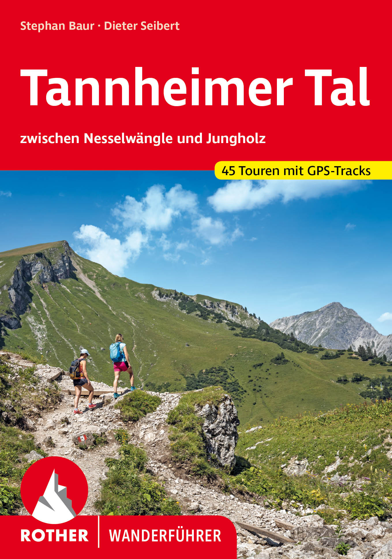
The Tannheimer Bergen are part of the Allgäuer Alps. Like the surrounding areas, the mountains are built up of different types of limestone.
The peaks here are lower than the surrounding mountain groups, and therefore, the area is much less known. Kellenspitze is the highest one (2238 m). That's not to say that this ensures simple walking. Those who wish to follow the main chain, over the German-Austrian border, must prepare for steep heights and exposed trails.
Map

Trails in this region
Links
Facts
Reports
Guides and maps
Lodging
Organisations
Tour operators
GPS
Other
Books

Stanfords
United Kingdom
United Kingdom
- Tannheimer Tal F&B WK5352
- Tannheimer Tal - Füssen - Forchach area of the Austrian and Bavarian Alps presented at 1:35,000 in a series of contoured and GPS compatible outdoor leisure map from Freytag & Berndt with hiking and cycling routes, mountain huts, campsites and youth hostels, local bus stops, plus other tourist information. Cartography is an enlargement of the... Read more

Bol.com
Netherlands
Netherlands
- Over the Top & Back Again
- Book of the Year Bronze Award 2010 (travel essays category), ForeWord Magazine After hiking some of the world's great trails, Brandon Wilson was excited to hear about the Via Alpina, paths running across eight countries on the backbone of the Alps. Besides promising immersion into Alpine life and wilderness, it was the ultimate adventure. It... Read more
- Also available from:
- Bol.com, Belgium
Bol.com
Belgium
Belgium
- Over the Top & Back Again
- Book of the Year Bronze Award 2010 (travel essays category), ForeWord Magazine After hiking some of the world's great trails, Brandon Wilson was excited to hear about the Via Alpina, paths running across eight countries on the backbone of the Alps. Besides promising immersion into Alpine life and wilderness, it was the ultimate adventure. It... Read more


Bol.com
Netherlands
Netherlands
- WF5421 Allgäu, Allgäuer Alpen Kompass
- De Kompass wandelgids + kaart geeft een overzicht van alle wandelroutes in het gebied met nauwkeurige routeaanwijzingen en hoogteaanduidingen, De extra grote kaart, schaal 1:35 000, is ideaal om van te voren uw route uit te stippelen en om onderweg te gebruiken • naast de bekende bestemmingen, worden ook de minder bekende vermeld • openbaar... Read more
- Also available from:
- Bol.com, Belgium
Bol.com
Belgium
Belgium
- WF5421 Allgäu, Allgäuer Alpen Kompass
- De Kompass wandelgids + kaart geeft een overzicht van alle wandelroutes in het gebied met nauwkeurige routeaanwijzingen en hoogteaanduidingen, De extra grote kaart, schaal 1:35 000, is ideaal om van te voren uw route uit te stippelen en om onderweg te gebruiken • naast de bekende bestemmingen, worden ook de minder bekende vermeld • openbaar... Read more

Bol.com
Netherlands
2017
Netherlands
2017
- Griechenland: Trans Kreta E4
- Kein Geheimtipp und dennoch etwas in Vergessenheit geraten ist das ber 500 km lange Teilst ck des europ ischen Fernwanderweges E4 auf Kreta. Bereits seit den 1970er-Jahren geh rt dieser Abschnitt zu einem der beliebtesten des l ngsten europ ischen Fernwanderweges und ist somit ein echter Trekkingklassiker.Wer gut markierte Pfade und verl... Read more
- Also available from:
- Bol.com, Belgium
- De Zwerver, Netherlands
Bol.com
Belgium
2017
Belgium
2017
- Griechenland: Trans Kreta E4
- Kein Geheimtipp und dennoch etwas in Vergessenheit geraten ist das ber 500 km lange Teilst ck des europ ischen Fernwanderweges E4 auf Kreta. Bereits seit den 1970er-Jahren geh rt dieser Abschnitt zu einem der beliebtesten des l ngsten europ ischen Fernwanderweges und ist somit ein echter Trekkingklassiker.Wer gut markierte Pfade und verl... Read more

De Zwerver
Netherlands
2017
Netherlands
2017
- Wandelgids E4 Kreta Lefka Ori und Lasithi | Conrad Stein Verlag
- OutdoorHandbuch. 3. Auflage. Read more

Bol.com
Netherlands
2019
Netherlands
2019
- WF5966 Julische Alpen mit Karte Kompass
- De Kompass wandelgids + kaart geeft een overzicht van alle wandelroutes in het gebied met nauwkeurige routeaanwijzingen en hoogteaanduidingen, De extra grote kaart, schaal 1:35 000, is ideaal om van te voren uw route uit te stippelen en om onderweg te gebruiken; naast de bekende bestemmingen, worden ook de minder bekende vermeld; openbaar... Read more
- Also available from:
- Bol.com, Belgium
Bol.com
Belgium
2019
Belgium
2019
- WF5966 Julische Alpen mit Karte Kompass
- De Kompass wandelgids + kaart geeft een overzicht van alle wandelroutes in het gebied met nauwkeurige routeaanwijzingen en hoogteaanduidingen, De extra grote kaart, schaal 1:35 000, is ideaal om van te voren uw route uit te stippelen en om onderweg te gebruiken; naast de bekende bestemmingen, worden ook de minder bekende vermeld; openbaar... Read more

Stanfords
United Kingdom
2011
United Kingdom
2011
- Alps Trekking
- An inspirational walking guide to 20 summer treks in the European Alps in Italy, Austria, Switzerland, France and Slovenia, by 8 Alpine trekking experts, including the classics such as the Tour of Mont Blanc and lesser-known routes like the Traverse of the Slovenian Alps. All the rich scenic diversity for which the Alps are renowned is... Read more
- Also available from:
- The Book Depository, United Kingdom
- Bol.com, Netherlands
- Bol.com, Belgium
- De Zwerver, Netherlands

The Book Depository
United Kingdom
2011
United Kingdom
2011
- Trekking in the Alps
- An inspirational guidebook to 20 classic treks in the Alps. As well as introducing new hiking areas in the Alps, classics such as the Tour of Mont Blanc, and Chamonix to Zermatt are included. Trekking in the Alps is immensely satisfying, and this book celebrates the rich and scenic diversity for which this great mountain range is renowned. Read more

Bol.com
Netherlands
2011
Netherlands
2011
- Trekking in the Alps
- An inspirational guide to the delights of Alpine multi-day hikes. With 20 hikes described, including classics such as the Tour of Mont Blanc and the Tour of the Vanoise as well as new multi-day routes like the Traverse of the Slovenian Alps, this guide celebrates the rich scenic diversity for which the Alps are renowned.The eight talented... Read more
Bol.com
Belgium
2011
Belgium
2011
- Trekking in the Alps
- An inspirational guide to the delights of Alpine multi-day hikes. With 20 hikes described, including classics such as the Tour of Mont Blanc and the Tour of the Vanoise as well as new multi-day routes like the Traverse of the Slovenian Alps, this guide celebrates the rich scenic diversity for which the Alps are renowned.The eight talented... Read more

De Zwerver
Netherlands
2019
Netherlands
2019
- Wandelgids Trekking in the Alps | Cicerone
- An inspirational guidebook to 20 classic treks in the Alps. As well as introducing new hiking areas in the Alps, classics such as the Tour of Mont Blanc, and Chamonix to Zermatt are included. Trekking in the Alps is immensely satisfying, and this book celebrates the rich and scenic diversity for which this great mountain range is renowned. Read more

Bol.com
Netherlands
Netherlands
- Wanderland Schweiz 02. Trans Swiss Trail
- Das Wanderland Schweiz besteht aus 6 nationalen Routen und 51 mehrtägigenHighlights. Die Routen basieren auf dem bestehenden Wanderwegnetz und integrierenteilweise bereits bestehende Angebote wie beispielsweise Via Alpina, Jura Höhenweg,Via Jacobi oder Rheintaler Höhenweg.Alle 9 Führer sind mit Farbfotos, Karten und Höhenprofilen farbig reich... Read more
- Also available from:
- Bol.com, Belgium
Bol.com
Belgium
Belgium
- Wanderland Schweiz 02. Trans Swiss Trail
- Das Wanderland Schweiz besteht aus 6 nationalen Routen und 51 mehrtägigenHighlights. Die Routen basieren auf dem bestehenden Wanderwegnetz und integrierenteilweise bereits bestehende Angebote wie beispielsweise Via Alpina, Jura Höhenweg,Via Jacobi oder Rheintaler Höhenweg.Alle 9 Führer sind mit Farbfotos, Karten und Höhenprofilen farbig reich... Read more


Bol.com
Netherlands
2014
Netherlands
2014
- Walking in the Bavarian Alps
- Guidebook describing a both valley and mountain walks and treks in the Bavarian Alps. 85 walks are covered, including graded mountain routes, gentler valley walks, hut-to-hut routes and two multi-day tours, arranged by region with practical information on transport, accommodation and the like. Since the last edition of this guide many of the... Read more
- Also available from:
- Bol.com, Belgium
Bol.com
Belgium
2014
Belgium
2014
- Walking in the Bavarian Alps
- Guidebook describing a both valley and mountain walks and treks in the Bavarian Alps. 85 walks are covered, including graded mountain routes, gentler valley walks, hut-to-hut routes and two multi-day tours, arranged by region with practical information on transport, accommodation and the like. Since the last edition of this guide many of the... Read more

- Also available from:
- Bol.com, Belgium

De Zwerver
Netherlands
2022
Netherlands
2022

De Zwerver
Netherlands
2018
Netherlands
2018
- Wandelgids Tourist route E4 in Bulgaria | Oilaripi
- Verrassend goede wandelgids van een deel van de E4 in Bulgarije. Goede kaarten, hoogteprofielen, prima beschrijvingen en praktische informatie maken het een volwaardige wandelgids die je in eerste instantie van dit gebied niet zou verwachten. Guidebook along the main ridge of the great alpine route E4 in Bulgaria, also known as �the fiv... Read more
More books…

Maps

Stanfords
United Kingdom
United Kingdom
- Styrian Winelands - Southwest Styria F&B WK411
- Styrian Winelands area south-eastern Austria presented at 1:50,000 in a series of contoured and GPS compatible outdoor leisure map from Freytag & Berndt with hiking and cycling routes, mountain huts, campsites and youth hostels, local bus stops, plus other tourist information. To see the list of currently available titles in this series please... Read more

Stanfords
United Kingdom
United Kingdom
- Goms - Aletsch
- Goms - Aletsch area of the Bernese Oberland at 1:50,000 in a series from Hallwag covering Switzerland’s popular hiking regions on light, waterproof and tear-resistant maps highlighting long-distance paths: the nine national routes plus special regional routes, as well as other local hiking trails.Cartography is similar to that used both in... Read more

Stanfords
United Kingdom
United Kingdom
- Olympus Geopsis 139
- Mt Olympus in a series of waterproof and tear-resistant hiking maps at scales varying from 1:50,000 to 1:10,000, with a UTM grid for GPS users. Contour interval varies depending on the scale, on most maps it is 20m. Relief shading, spot heights, springs, seasonal streams and, in most titles, landscape/land-use variations, e.g. forests,... Read more

Stanfords
United Kingdom
United Kingdom
- Cinque Terre - Golfo del Tigullio: La Spezia - Sestri Levante - Rapallo - Genoa 50K IGC Map No. 23
- Cinque Terre - Golfo del Tigullio area of the Italian Riviera from genoa to la Spezia including Sestri Levante and Rapallo in a series contoured hiking maps at 1:50,000 with local trails, long-distance footpaths, mountain accommodation, etc. from the Turin based Istituto Geografico Centrale.Maps in this series have contours at 50m intervals,... Read more

Stanfords
United Kingdom
United Kingdom
- Val Venosta / Vinschgau K+F Outdoor Map 1
- Val Venosta / Vinschgau area in the Dolomites at 1:50,000 in a series of waterproof and tear-resistant, GPS compatible and contoured recreational maps from Kümmerly + Frey with both local and long-distance hiking and cycling trails, ski routes, sites for other outdoor pursuits, accommodation, bus stops, etc. Coverage includes the Ortles/Ortler... Read more
Stanfords
United Kingdom
United Kingdom
- Montreux
- Montreux - Col du Pillon area at 1:50,000 in a series from Hallwag covering Switzerland’s popular hiking regions on light, waterproof and tear-resistant maps highlighting long-distance paths: the nine national routes plus special regional routes, as well as other local hiking trails.Cartography is similar to that used both in Hallwag’s hiking... Read more

Stanfords
United Kingdom
United Kingdom
- E4 Arquipelago de Cabo Verde
- Plans included:Porto Novo (Ilha de Santo Antão) (1:10 000)Mindelo (Porto Grande) (Ilha de São Vicente) (1:20 000)Ilha de Santa Luzia (1:not known)Porto de Tarrafal (Ilha de São Nicolau) (1:8500)Porto da Preguiça (Ilha de São Nicolau) (1:8500)Baía da Palmeira (Ilha do Sal) (1:15 000)Porto de Sal-Rei (Ilha da Boavista) (1:30 000)Porto da Praia... Read more

Stanfords
United Kingdom
United Kingdom
- Lake Maggiore - Lake Orta - Lake Varese K+F Outdoor Map 8
- Lake Maggiore - Lake Orta - Lake Varese area at 1:50,000 in a series of waterproof and tear-resistant, GPS compatible and contoured recreational maps from Kümmerly + Frey with both local and long-distance hiking and cycling trails, ski routes, sites for other outdoor pursuits, accommodation, bus stops, etc. An inset provides a small road map of... Read more

Stanfords
United Kingdom
United Kingdom
- Peloponnese Anavasi Road Atlas
- Road Atlas of the Peloponnese from Anavasi, in an A4 paperback format, with contoured, GPS compatible mapping at 1:50,000, very detailed road classification, hiking paths, and place names in both Greek and Latin alphabets.The main section of the atlas has 178 pages of detailed maps with contours at 100m intervals, altitude colouring and relief... Read more

Stanfords
United Kingdom
United Kingdom
- Füssen - Pfronten - Forggensee - Neuschwanstein - Tannheimer Tal K+F Outdorre Map 2
- Füssen - Pfronten area of the German Alps at 1:35,000 from Kümmerly+Frey in a series GPS compatible, double-sided maps printed on durable, waterproof and tear-resistant plastic paper; contoured, with hiking and cycle routes, other recreational activities, etc. Coverage includes the Neuschweinstein Castle.Maps in this series are at a scale of... Read more

Stanfords
United Kingdom
United Kingdom
- Hungarian National Long-distance Blue Trail (E4): Visegrad to Irott-ko
- Hiking guide to the north-western section of Hungary’s National Blue Trail which forms part of the E4 European long-distance footpath. The guide covers the route from the historic town of Visegrád on the Danube, across the Buda Hills on the outskirts of Budapest and the Bakony Hills along the north-eastern shore of Lake Balaton, to Írott-ko in... Read more

Stanfords
United Kingdom
United Kingdom
- Taygetos - North Taygetos Anavasi 8.1
- The Taygetos range between Sparta and Kalamata at 1:50,000 on a contoured, GPS compatible map from Anavasi with on the reverse a special map highlighting the region’s numerous hiking trails, including the course of the E4 European long-distance path.On one side is the main map of the area with excellent presentation of its topography by... Read more

Stanfords
United Kingdom
United Kingdom
- Greece: Attika and Central Greece Road Atlas
- Road Atlas of Attika, the region around Athens, and Central Greece from Anavasi, in an A4 paperback format, with contoured mapping at 1:50,000, a 2km UTM grid for GPS users, very detailed road classification, hiking paths, and place names in both Greek and Latin alphabets.The main section of the atlas has 219 pages of detailed maps with... Read more

Stanfords
United Kingdom
United Kingdom
- Lake Como K+F Outdoor Map 9
- Lake Como area at 1:50,000 on a double-sided, waterproof and tear-resistant, GPS compatible and contoured recreational maps from Kümmerly + Frey with both local and long-distance hiking and cycling trails, ski routes, sites for other outdoor pursuits, accommodation, bus stops, etc. Coverage includes the northern part of Lake Lugano and extends... Read more
Stanfords
United Kingdom
United Kingdom
- Bregenz F&B
- Indexed street plan of Bregenz extending north along the Bodensee coast to Lochau and Unter Hochsteg. Detail includes pedestrianised areas, railways, bus routes and cycle paths. Notable buildings are highlighted in red, and symbols indicate post offices, hostels, campsites and car parks.On the reverse is a 1:50,000 contoured map of the... Read more